You are here: Home > Network List > TA - USArray Transportable Network (new EarthScope stations) Stations List
> Station O27A Beecher Island, Eckley, CO, USA > Earthquake Result Viewer
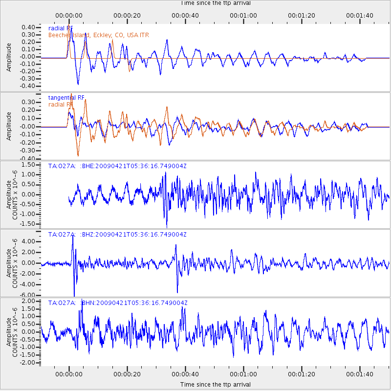
O27A Beecher Island, Eckley, CO, USA - Earthquake Result Viewer
*The percent match for this event was below the threshold and hence no stack was calculated.
| Earthquake location: |
Kuril Islands |
| Earthquake latitude/longitude: |
50.8/155.0 |
| Earthquake time(UTC): |
2009/04/21 (111) 05:26:11 GMT |
| Earthquake Depth: |
152 km |
| Earthquake Magnitude: |
6.0 MB, 6.2 MW, 6.2 MW |
| Earthquake Catalog/Contributor: |
WHDF/NEIC |
|
| Network: |
TA USArray Transportable Network (new EarthScope stations) |
| Station: |
O27A Beecher Island, Eckley, CO, USA |
| Lat/Lon: |
40.19 N/102.48 W |
| Elevation: |
1206 m |
|
| Distance: |
66.9 deg |
| Az: |
54.373 deg |
| Baz: |
317.712 deg |
| Ray Param: |
$rayparam |
*The percent match for this event was below the threshold and hence was not used in the summary stack. |
|
| Radial Match: |
79.75239 % |
| Radial Bump: |
400 |
| Transverse Match: |
47.076374 % |
| Transverse Bump: |
400 |
| SOD ConfigId: |
2760 |
| Insert Time: |
2010-03-06 15:25:20.058 +0000 |
| GWidth: |
2.5 |
| Max Bumps: |
400 |
| Tol: |
0.001 |
|
Signal To Noise
| Channel | StoN | STA | LTA |
| TA:O27A: :BHZ:20090421T05:36:16.749004Z | 11.910836 | 1.9018593E-6 | 1.596747E-7 |
| TA:O27A: :BHN:20090421T05:36:16.749004Z | 1.4672008 | 6.4020855E-7 | 4.3634694E-7 |
| TA:O27A: :BHE:20090421T05:36:16.749004Z | 2.151644 | 5.9567674E-7 | 2.7684726E-7 |
| Arrivals |
| Ps | |
| PpPs | |
| PsPs/PpSs | |


