You are here: Home > Network List > IW - Intermountain West Stations List
> Station DLMT Dillon, Montana, USA > Earthquake Result Viewer
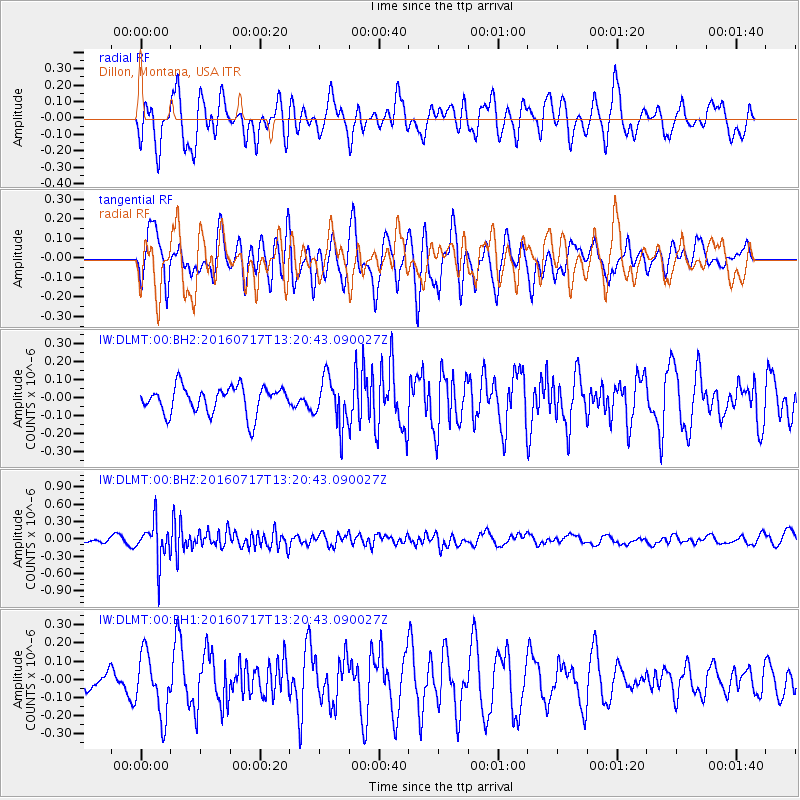
DLMT Dillon, Montana, USA - Earthquake Result Viewer
*The percent match for this event was below the threshold and hence no stack was calculated.
| Earthquake location: |
Tonga Islands |
| Earthquake latitude/longitude: |
-17.7/-174.2 |
| Earthquake time(UTC): |
2016/07/17 (199) 13:08:53 GMT |
| Earthquake Depth: |
79 km |
| Earthquake Magnitude: |
5.6 MB |
| Earthquake Catalog/Contributor: |
NEIC PDE/NEIC ALERT |
|
| Network: |
IW Intermountain West |
| Station: |
DLMT Dillon, Montana, USA |
| Lat/Lon: |
45.36 N/112.60 W |
| Elevation: |
1569 m |
|
| Distance: |
83.9 deg |
| Az: |
38.573 deg |
| Baz: |
237.482 deg |
| Ray Param: |
$rayparam |
*The percent match for this event was below the threshold and hence was not used in the summary stack. |
|
| Radial Match: |
44.5487 % |
| Radial Bump: |
400 |
| Transverse Match: |
49.57323 % |
| Transverse Bump: |
400 |
| SOD ConfigId: |
1634031 |
| Insert Time: |
2016-07-31 13:11:22.641 +0000 |
| GWidth: |
2.5 |
| Max Bumps: |
400 |
| Tol: |
0.001 |
|
Signal To Noise
| Channel | StoN | STA | LTA |
| IW:DLMT:00:BHZ:20160717T13:20:43.090027Z | 6.097988 | 3.4469835E-7 | 5.652657E-8 |
| IW:DLMT:00:BH1:20160717T13:20:43.090027Z | 1.9904417 | 1.6851493E-7 | 8.4662084E-8 |
| IW:DLMT:00:BH2:20160717T13:20:43.090027Z | 1.7268039 | 1.302345E-7 | 7.541939E-8 |
| Arrivals |
| Ps | |
| PpPs | |
| PsPs/PpSs | |


