You are here: Home > Network List > US - United States National Seismic Network Stations List
> Station DGMT Dagmar, Montana, USA > Earthquake Result Viewer
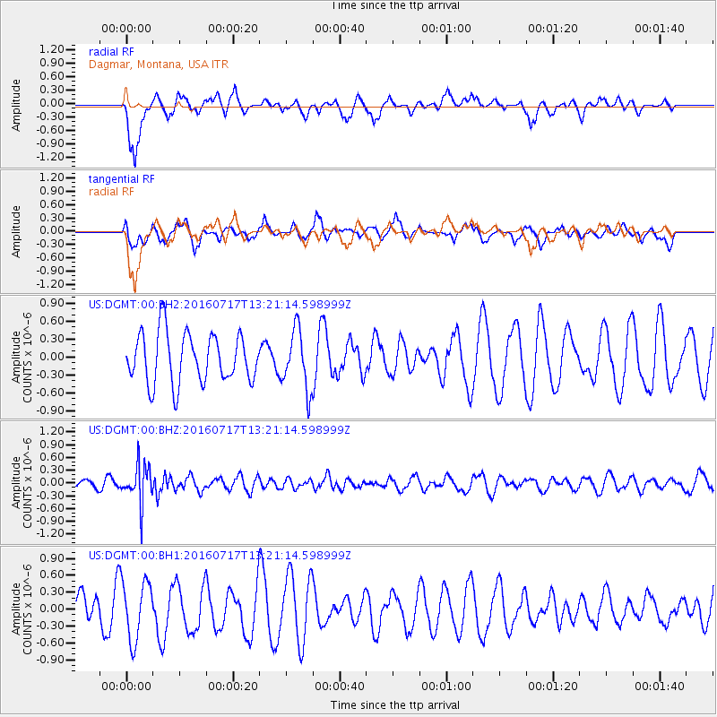
DGMT Dagmar, Montana, USA - Earthquake Result Viewer
*The percent match for this event was below the threshold and hence no stack was calculated.
| Earthquake location: |
Tonga Islands |
| Earthquake latitude/longitude: |
-17.7/-174.2 |
| Earthquake time(UTC): |
2016/07/17 (199) 13:08:53 GMT |
| Earthquake Depth: |
79 km |
| Earthquake Magnitude: |
5.6 MB |
| Earthquake Catalog/Contributor: |
NEIC PDE/NEIC ALERT |
|
| Network: |
US United States National Seismic Network |
| Station: |
DGMT Dagmar, Montana, USA |
| Lat/Lon: |
48.47 N/104.20 W |
| Elevation: |
0.0 m |
|
| Distance: |
90.4 deg |
| Az: |
38.703 deg |
| Baz: |
243.613 deg |
| Ray Param: |
$rayparam |
*The percent match for this event was below the threshold and hence was not used in the summary stack. |
|
| Radial Match: |
61.635124 % |
| Radial Bump: |
388 |
| Transverse Match: |
53.666557 % |
| Transverse Bump: |
400 |
| SOD ConfigId: |
1634031 |
| Insert Time: |
2016-07-31 13:12:52.223 +0000 |
| GWidth: |
2.5 |
| Max Bumps: |
400 |
| Tol: |
0.001 |
|
Signal To Noise
| Channel | StoN | STA | LTA |
| US:DGMT:00:BHZ:20160717T13:21:14.598999Z | 2.7403953 | 4.6064775E-7 | 1.6809537E-7 |
| US:DGMT:00:BH1:20160717T13:21:14.598999Z | 1.9106534 | 5.1919653E-7 | 2.717377E-7 |
| US:DGMT:00:BH2:20160717T13:21:14.598999Z | 1.1949464 | 5.0003274E-7 | 4.184562E-7 |
| Arrivals |
| Ps | |
| PpPs | |
| PsPs/PpSs | |


