You are here: Home > Network List > US - United States National Seismic Network Stations List
> Station MSO Missoula, Montana, USA > Earthquake Result Viewer
MSO Missoula, Montana, USA - Earthquake Result Viewer
*The percent match for this event was below the threshold and hence no stack was calculated.
| Earthquake location: |
Tonga Islands |
| Earthquake latitude/longitude: |
-17.7/-174.2 |
| Earthquake time(UTC): |
2016/07/17 (199) 13:08:53 GMT |
| Earthquake Depth: |
79 km |
| Earthquake Magnitude: |
5.6 MB |
| Earthquake Catalog/Contributor: |
NEIC PDE/NEIC ALERT |
|
| Network: |
US United States National Seismic Network |
| Station: |
MSO Missoula, Montana, USA |
| Lat/Lon: |
46.83 N/113.94 W |
| Elevation: |
1264 m |
|
| Distance: |
83.9 deg |
| Az: |
36.824 deg |
| Baz: |
236.331 deg |
| Ray Param: |
$rayparam |
*The percent match for this event was below the threshold and hence was not used in the summary stack. |
|
| Radial Match: |
54.0277 % |
| Radial Bump: |
400 |
| Transverse Match: |
49.394753 % |
| Transverse Bump: |
400 |
| SOD ConfigId: |
1634031 |
| Insert Time: |
2016-07-31 13:13:36.961 +0000 |
| GWidth: |
2.5 |
| Max Bumps: |
400 |
| Tol: |
0.001 |
|
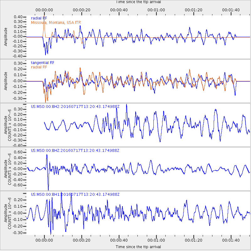
Signal To Noise
| Channel | StoN | STA | LTA |
| US:MSO:00:BHZ:20160717T13:20:43.174988Z | 3.1581495 | 2.577583E-7 | 8.1616875E-8 |
| US:MSO:00:BH1:20160717T13:20:43.174988Z | 1.953519 | 1.4698269E-7 | 7.523996E-8 |
| US:MSO:00:BH2:20160717T13:20:43.174988Z | 2.0351975 | 1.13123235E-7 | 5.558342E-8 |
| Arrivals |
| Ps | |
| PpPs | |
| PsPs/PpSs | |


