You are here: Home > Network List > UU - University of Utah Regional Network Stations List
> Station CCUT Cedar City, UT, USA > Earthquake Result Viewer
CCUT Cedar City, UT, USA - Earthquake Result Viewer
*The percent match for this event was below the threshold and hence no stack was calculated.
| Earthquake location: |
Tonga Islands |
| Earthquake latitude/longitude: |
-17.7/-174.2 |
| Earthquake time(UTC): |
2016/07/17 (199) 13:08:53 GMT |
| Earthquake Depth: |
79 km |
| Earthquake Magnitude: |
5.6 MB |
| Earthquake Catalog/Contributor: |
NEIC PDE/NEIC ALERT |
|
| Network: |
UU University of Utah Regional Network |
| Station: |
CCUT Cedar City, UT, USA |
| Lat/Lon: |
37.55 N/113.36 W |
| Elevation: |
2127 m |
|
| Distance: |
79.2 deg |
| Az: |
44.929 deg |
| Baz: |
237.908 deg |
| Ray Param: |
$rayparam |
*The percent match for this event was below the threshold and hence was not used in the summary stack. |
|
| Radial Match: |
77.61681 % |
| Radial Bump: |
318 |
| Transverse Match: |
27.906572 % |
| Transverse Bump: |
400 |
| SOD ConfigId: |
1634031 |
| Insert Time: |
2016-07-31 13:14:09.382 +0000 |
| GWidth: |
2.5 |
| Max Bumps: |
400 |
| Tol: |
0.001 |
|
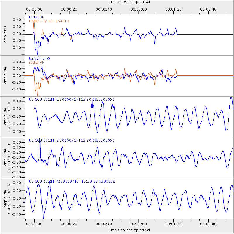
Signal To Noise
| Channel | StoN | STA | LTA |
| UU:CCUT:01:HHZ:20160717T13:20:18.630005Z | 1.8806882 | 2.393812E-7 | 1.2728384E-7 |
| UU:CCUT:01:HHN:20160717T13:20:18.630005Z | 2.4440122 | 2.5465303E-7 | 1.0419467E-7 |
| UU:CCUT:01:HHE:20160717T13:20:18.630005Z | 2.000536 | 2.230136E-7 | 1.1147692E-7 |
| Arrivals |
| Ps | |
| PpPs | |
| PsPs/PpSs | |


