
B12A Libby, MT, USA - Earthquake Result Viewer
| ||||||||||||||||||
| ||||||||||||||||||
| ||||||||||||||||||
|
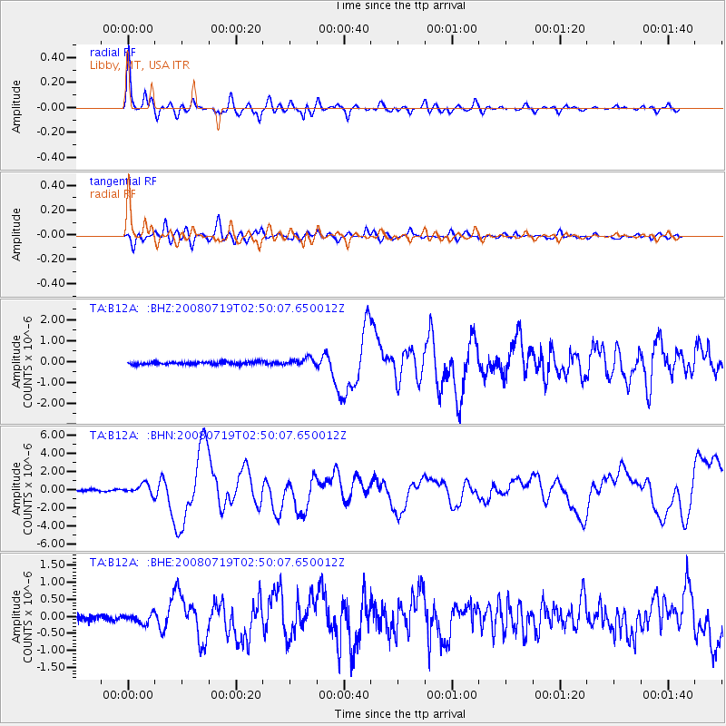
Signal To Noise
| Channel | StoN | STA | LTA |
| TA:B12A: :BHN:20080719T02:50:07.650012Z | 6.7629967 | 5.6500636E-7 | 8.354378E-8 |
| TA:B12A: :BHE:20080719T02:50:07.650012Z | 1.840611 | 1.4413598E-7 | 7.8308766E-8 |
| TA:B12A: :BHZ:20080719T02:50:07.650012Z | 2.7190888 | 1.7700964E-7 | 6.509888E-8 |
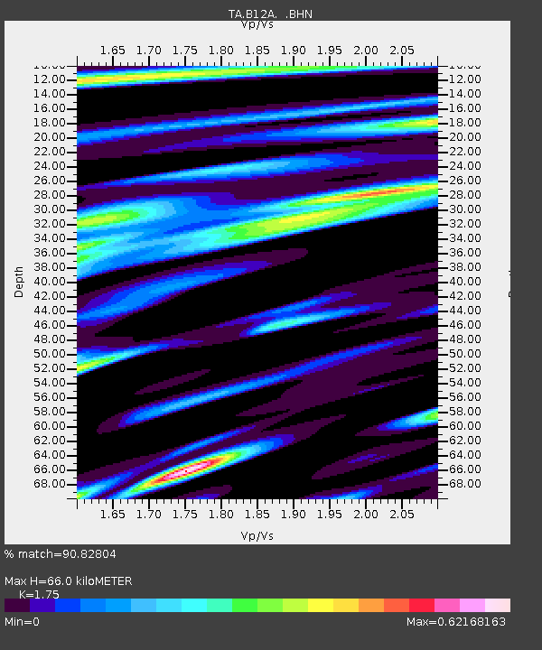
| Arrivals | |
| Ps | 7.8 SECOND |
| PpPs | 26 SECOND |
| PsPs/PpSs | 34 SECOND |

