You are here: Home > Network List > TA - USArray Transportable Network (new EarthScope stations) Stations List
> Station E20K Nigu River, AK, USA > Earthquake Result Viewer
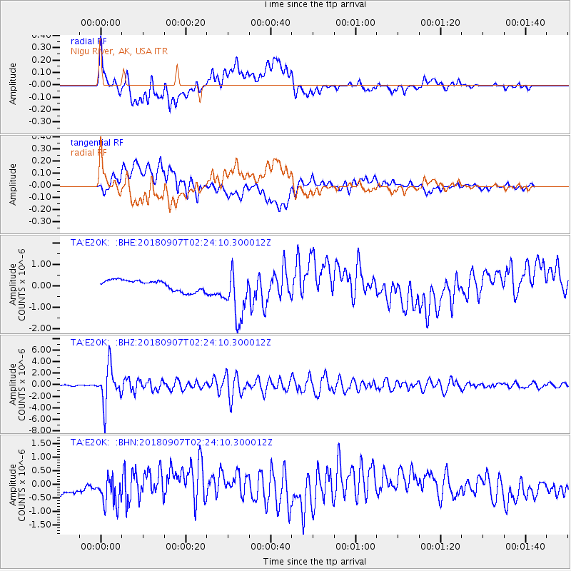
E20K Nigu River, AK, USA - Earthquake Result Viewer
*The percent match for this event was below the threshold and hence no stack was calculated.
| Earthquake location: |
Ecuador |
| Earthquake latitude/longitude: |
-2.3/-78.9 |
| Earthquake time(UTC): |
2018/09/07 (250) 02:12:04 GMT |
| Earthquake Depth: |
94 km |
| Earthquake Magnitude: |
6.2 Mww |
| Earthquake Catalog/Contributor: |
NEIC PDE/us |
|
| Network: |
TA USArray Transportable Network (new EarthScope stations) |
| Station: |
E20K Nigu River, AK, USA |
| Lat/Lon: |
68.26 N/156.19 W |
| Elevation: |
866 m |
|
| Distance: |
87.5 deg |
| Az: |
338.665 deg |
| Baz: |
102.669 deg |
| Ray Param: |
$rayparam |
*The percent match for this event was below the threshold and hence was not used in the summary stack. |
|
| Radial Match: |
54.631874 % |
| Radial Bump: |
400 |
| Transverse Match: |
57.762 % |
| Transverse Bump: |
400 |
| SOD ConfigId: |
13570011 |
| Insert Time: |
2019-05-01 04:00:51.921 +0000 |
| GWidth: |
2.5 |
| Max Bumps: |
400 |
| Tol: |
0.001 |
|
Signal To Noise
| Channel | StoN | STA | LTA |
| TA:E20K: :BHZ:20180907T02:24:10.300012Z | 47.25992 | 3.2884566E-6 | 6.9582356E-8 |
| TA:E20K: :BHN:20180907T02:24:10.300012Z | 1.7333252 | 5.526954E-7 | 3.188642E-7 |
| TA:E20K: :BHE:20180907T02:24:10.300012Z | 4.7100368 | 1.1799884E-6 | 2.5052637E-7 |
| Arrivals |
| Ps | |
| PpPs | |
| PsPs/PpSs | |


