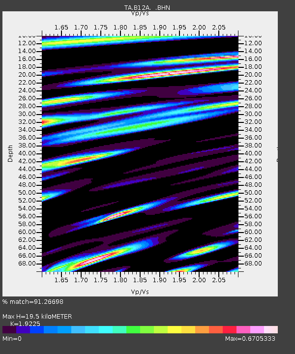
B12A Libby, MT, USA - Earthquake Result Viewer
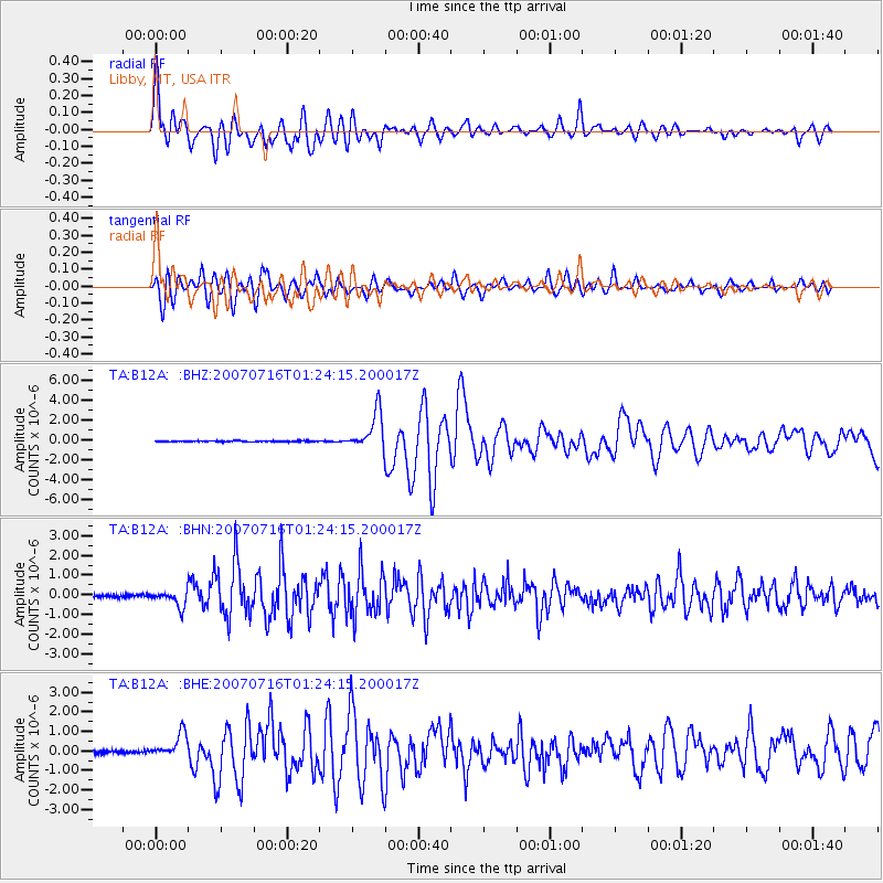
Earthquake location: Near West Coast Of Honshu, Japan
Earthquake latitude/longitude: 37.5/138.4
Earthquake time(UTC): 2007/07/16 (197) 01:13:22 GMT
Earthquake Depth: 12 km
Earthquake Magnitude: 6.5 MB, 6.4 MS, 6.6 MW, 6.5 MW
Earthquake Catalog/Contributor: WHDF/NEIC
Network: TA USArray Transportable Network (new EarthScope stations)
Station: B12A Libby, MT, USA
Lat/Lon: 48.47 N/115.59 W
Elevation: 764 m
Distance: 72.1 deg
Az: 42.251 deg
Baz: 306.568 deg
Ray Param: 0.053879343
Estimated Moho Depth: 19.5 km
Estimated Crust Vp/Vs: 1.92
Assumed Crust Vp: 6.622 km/s
Estimated Crust Vs: 3.445 km/s
Estimated Crust Poisson's Ratio: 0.31
Radial Match: 91.26698 %
Radial Bump: 400
Transverse Match: 84.30059 %
Transverse Bump: 400
SOD ConfigId: 2564
Insert Time: 2010-03-06 15:29:16.998 +0000
GWidth: 2.5
Max Bumps: 400
Tol: 0.001

Signal To Noise

ChannelStoNSTALTA
TA:B12A: :BHN:20070716T01:24:15.200017Z2.5322653.7163363E-71.4675938E-7
TA:B12A: :BHE:20070716T01:24:15.200017Z4.81690936.1524224E-71.2772553E-7
TA:B12A: :BHZ:20070716T01:24:15.200017Z38.612941.9124755E-64.9529394E-8
Arrivals
Ps2.8 SECOND
PpPs8.3 SECOND
PsPs/PpSs11 SECOND