
B12A Libby, MT, USA - Earthquake Result Viewer
| ||||||||||||||||||
| ||||||||||||||||||
| ||||||||||||||||||
|
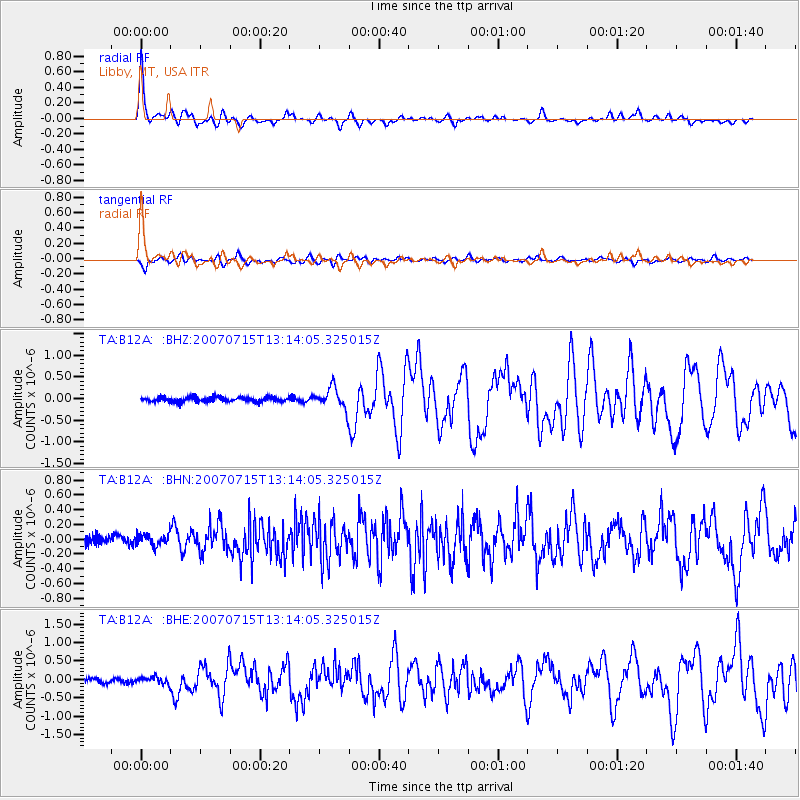
Signal To Noise
| Channel | StoN | STA | LTA |
| TA:B12A: :BHN:20070715T13:14:05.325015Z | 1.1498512 | 7.7404735E-8 | 6.731718E-8 |
| TA:B12A: :BHE:20070715T13:14:05.325015Z | 1.6669447 | 9.425707E-8 | 5.6544806E-8 |
| TA:B12A: :BHZ:20070715T13:14:05.325015Z | 4.5785694 | 2.4745654E-7 | 5.4046694E-8 |
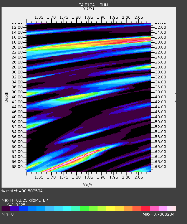
| Arrivals | |
| Ps | 8.6 SECOND |
| PpPs | 25 SECOND |
| PsPs/PpSs | 34 SECOND |

