B12A Libby, MT, USA - Earthquake Result Viewer
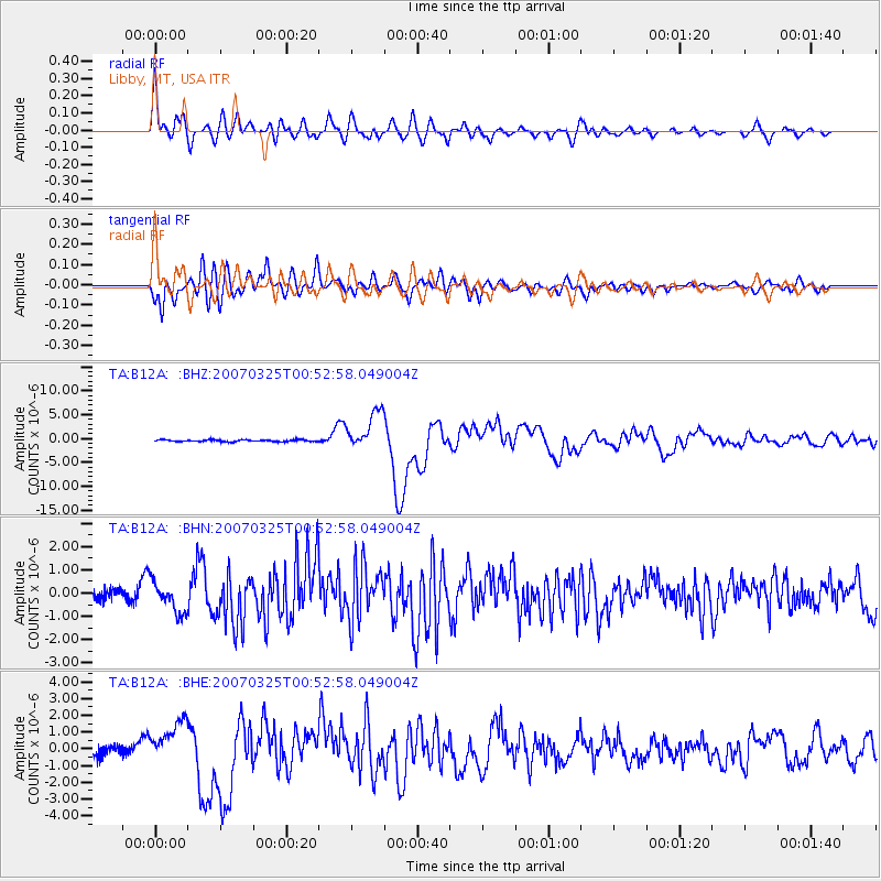
Earthquake location: Near West Coast Of Honshu, Japan
Earthquake latitude/longitude: 37.3/136.6
Earthquake time(UTC): 2007/03/25 (084) 00:41:57 GMT
Earthquake Depth: 8.0 km
Earthquake Magnitude: 6.1 MB, 6.8 MS, 6.7 MW, 6.6 MW
Earthquake Catalog/Contributor: WHDF/NEIC
Network: TA USArray Transportable Network (new EarthScope stations)
Station: B12A Libby, MT, USA
Lat/Lon: 48.47 N/115.59 W
Elevation: 764 m
Distance: 73.2 deg
Az: 41.429 deg
Baz: 307.583 deg
Ray Param: 0.053139422
Estimated Moho Depth: 69.75 km
Estimated Crust Vp/Vs: 1.97
Assumed Crust Vp: 6.622 km/s
Estimated Crust Vs: 3.362 km/s
Estimated Crust Poisson's Ratio: 0.33
Radial Match: 89.33901 %
Radial Bump: 400
Transverse Match: 82.75421 %
Transverse Bump: 400
SOD ConfigId: 2564
Insert Time: 2010-03-06 15:29:28.931 +0000
GWidth: 2.5
Max Bumps: 400
Tol: 0.001

Signal To Noise

ChannelStoNSTALTA
TA:B12A: :BHN:20070325T00:52:58.049004Z2.66274866.7091946E-72.51965E-7
TA:B12A: :BHE:20070325T00:52:58.049004Z4.5409771.2311406E-62.7111798E-7
TA:B12A: :BHZ:20070325T00:52:58.049004Z22.0476914.044778E-61.8345587E-7
Arrivals
Ps11 SECOND
PpPs30 SECOND
PsPs/PpSs41 SECOND