
B12A Libby, MT, USA - Earthquake Result Viewer
| ||||||||||||||||||
| ||||||||||||||||||
| ||||||||||||||||||
|
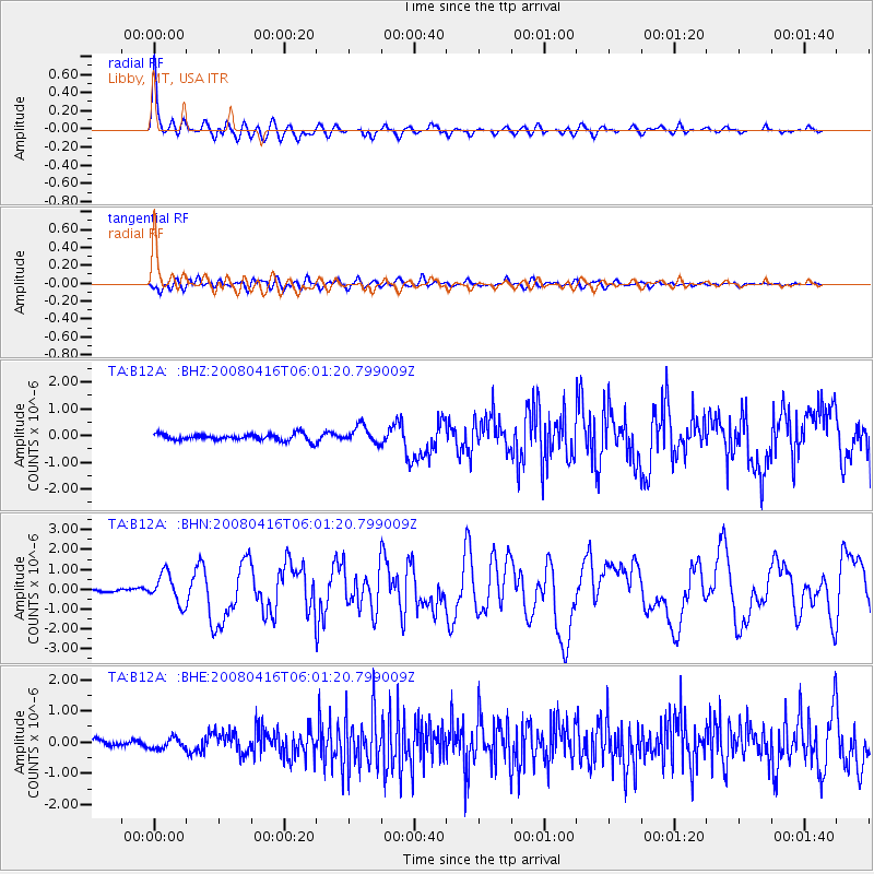
Signal To Noise
| Channel | StoN | STA | LTA |
| TA:B12A: :BHN:20080416T06:01:20.799009Z | 5.79379 | 7.476624E-7 | 1.2904547E-7 |
| TA:B12A: :BHE:20080416T06:01:20.799009Z | 0.9195345 | 1.7362399E-7 | 1.8881727E-7 |
| TA:B12A: :BHZ:20080416T06:01:20.799009Z | 2.6132073 | 3.2314304E-7 | 1.2365764E-7 |
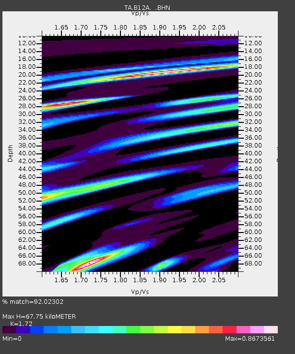
| Arrivals | |
| Ps | 8.0 SECOND |
| PpPs | 26 SECOND |
| PsPs/PpSs | 34 SECOND |

