B12A Libby, MT, USA - Earthquake Result Viewer
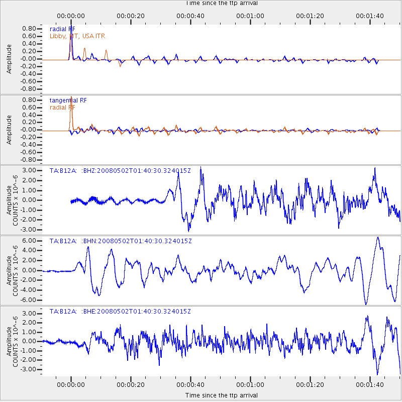
Earthquake location: Andreanof Islands, Aleutian Is.
Earthquake latitude/longitude: 51.9/-177.5
Earthquake time(UTC): 2008/05/02 (123) 01:33:37 GMT
Earthquake Depth: 14 km
Earthquake Magnitude: 6.3 MB, 6.8 MS, 6.6 MW, 6.6 MW
Earthquake Catalog/Contributor: WHDF/NEIC
Network: TA USArray Transportable Network (new EarthScope stations)
Station: B12A Libby, MT, USA
Lat/Lon: 48.47 N/115.59 W
Elevation: 764 m
Distance: 38.8 deg
Az: 69.702 deg
Baz: 299.086 deg
Ray Param: 0.07536119
Estimated Moho Depth: 69.75 km
Estimated Crust Vp/Vs: 1.63
Assumed Crust Vp: 6.622 km/s
Estimated Crust Vs: 4.063 km/s
Estimated Crust Poisson's Ratio: 0.20
Radial Match: 86.01452 %
Radial Bump: 217
Transverse Match: 69.48001 %
Transverse Bump: 400
SOD ConfigId: 2504
Insert Time: 2010-03-06 15:30:19.007 +0000
GWidth: 2.5
Max Bumps: 400
Tol: 0.001

Signal To Noise

ChannelStoNSTALTA
TA:B12A: :BHN:20080502T01:40:30.324015Z4.88334669.091398E-71.8617148E-7
TA:B12A: :BHE:20080502T01:40:30.324015Z1.54539632.443092E-71.5808837E-7
TA:B12A: :BHZ:20080502T01:40:30.324015Z3.2525395.9211953E-71.8204841E-7
Arrivals
Ps7.2 SECOND
PpPs25 SECOND
PsPs/PpSs33 SECOND