You are here: Home > Network List > TA - USArray Transportable Network (new EarthScope stations) Stations List
> Station B12A Libby, MT, USA > Earthquake Result Viewer
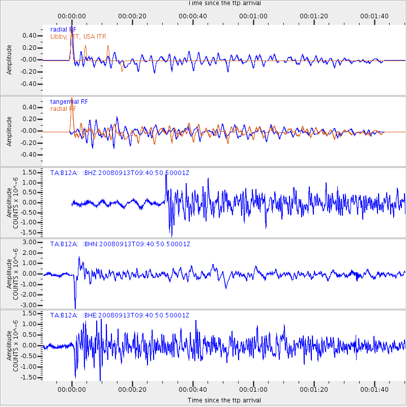
B12A Libby, MT, USA - Earthquake Result Viewer
*The percent match for this event was below the threshold and hence no stack was calculated.
| Earthquake location: |
Colombia |
| Earthquake latitude/longitude: |
4.8/-75.5 |
| Earthquake time(UTC): |
2008/09/13 (257) 09:32:01 GMT |
| Earthquake Depth: |
133 km |
| Earthquake Magnitude: |
5.9 MB, 5.7 MW, 5.7 MW |
| Earthquake Catalog/Contributor: |
WHDF/NEIC |
|
| Network: |
TA USArray Transportable Network (new EarthScope stations) |
| Station: |
B12A Libby, MT, USA |
| Lat/Lon: |
48.47 N/115.59 W |
| Elevation: |
764 m |
|
| Distance: |
55.3 deg |
| Az: |
328.589 deg |
| Baz: |
128.702 deg |
| Ray Param: |
$rayparam |
*The percent match for this event was below the threshold and hence was not used in the summary stack. |
|
| Radial Match: |
76.20411 % |
| Radial Bump: |
400 |
| Transverse Match: |
71.06831 % |
| Transverse Bump: |
400 |
| SOD ConfigId: |
2560 |
| Insert Time: |
2010-03-06 15:31:01.836 +0000 |
| GWidth: |
2.5 |
| Max Bumps: |
400 |
| Tol: |
0.001 |
|
Signal To Noise
| Channel | StoN | STA | LTA |
| TA:B12A: :BHN:20080913T09:40:50.50001Z | 17.072897 | 9.871083E-7 | 5.7817267E-8 |
| TA:B12A: :BHE:20080913T09:40:50.50001Z | 5.882521 | 5.6000545E-7 | 9.519821E-8 |
| TA:B12A: :BHZ:20080913T09:40:50.50001Z | 6.6642556 | 6.5212646E-7 | 9.785436E-8 |
| Arrivals |
| Ps | |
| PpPs | |
| PsPs/PpSs | |


