You are here: Home > Network List > TA - USArray Transportable Network (new EarthScope stations) Stations List
> Station B12A Libby, MT, USA > Earthquake Result Viewer
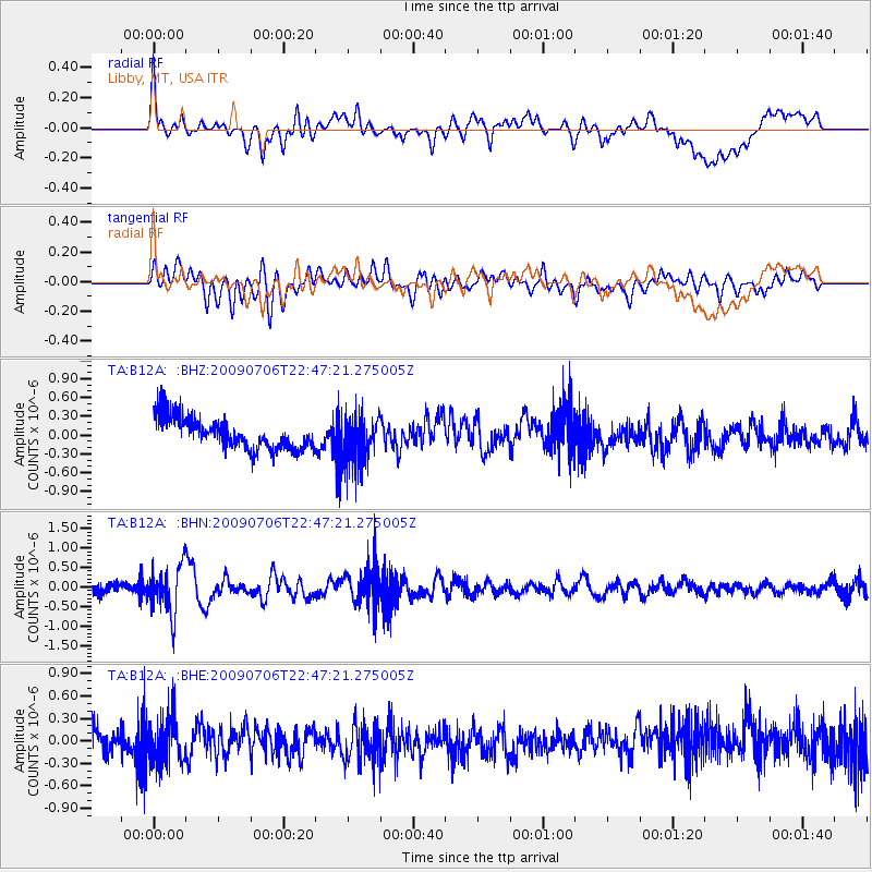
B12A Libby, MT, USA - Earthquake Result Viewer
*The percent match for this event was below the threshold and hence no stack was calculated.
| Earthquake location: |
Southeast Of Ryukyu Islands |
| Earthquake latitude/longitude: |
24.9/128.0 |
| Earthquake time(UTC): |
2009/07/06 (187) 22:35:05 GMT |
| Earthquake Depth: |
10 km |
| Earthquake Magnitude: |
6.1 MB, 5.3 MS, 5.7 MW, 5.7 MW |
| Earthquake Catalog/Contributor: |
WHDF/NEIC |
|
| Network: |
TA USArray Transportable Network (new EarthScope stations) |
| Station: |
B12A Libby, MT, USA |
| Lat/Lon: |
48.47 N/115.59 W |
| Elevation: |
764 m |
|
| Distance: |
87.5 deg |
| Az: |
36.638 deg |
| Baz: |
305.465 deg |
| Ray Param: |
$rayparam |
*The percent match for this event was below the threshold and hence was not used in the summary stack. |
|
| Radial Match: |
34.52732 % |
| Radial Bump: |
400 |
| Transverse Match: |
40.316113 % |
| Transverse Bump: |
400 |
| SOD ConfigId: |
2648 |
| Insert Time: |
2010-03-06 15:31:18.405 +0000 |
| GWidth: |
2.5 |
| Max Bumps: |
400 |
| Tol: |
0.001 |
|
Signal To Noise
| Channel | StoN | STA | LTA |
| TA:B12A: :BHN:20090706T22:47:21.275005Z | 5.933346 | 6.0092947E-7 | 1.0128004E-7 |
| TA:B12A: :BHE:20090706T22:47:21.275005Z | 0.93847406 | 3.0574878E-7 | 3.2579354E-7 |
| TA:B12A: :BHZ:20090706T22:47:21.275005Z | 1.424054 | 3.5285694E-7 | 2.477834E-7 |
| Arrivals |
| Ps | |
| PpPs | |
| PsPs/PpSs | |


