You are here: Home > Network List > TA - USArray Transportable Network (new EarthScope stations) Stations List
> Station B12A Libby, MT, USA > Earthquake Result Viewer
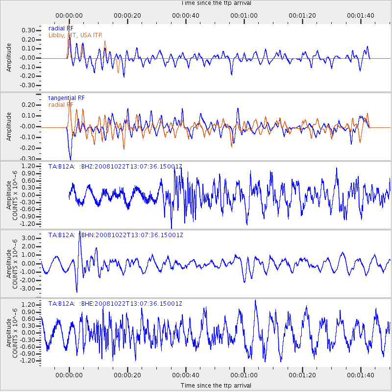
B12A Libby, MT, USA - Earthquake Result Viewer
*The percent match for this event was below the threshold and hence no stack was calculated.
| Earthquake location: |
Tonga Islands |
| Earthquake latitude/longitude: |
-18.4/-175.4 |
| Earthquake time(UTC): |
2008/10/22 (296) 12:55:57 GMT |
| Earthquake Depth: |
233 km |
| Earthquake Magnitude: |
5.9 MB, 6.4 MW, 6.3 MW |
| Earthquake Catalog/Contributor: |
WHDF/NEIC |
|
| Network: |
TA USArray Transportable Network (new EarthScope stations) |
| Station: |
B12A Libby, MT, USA |
| Lat/Lon: |
48.47 N/115.59 W |
| Elevation: |
764 m |
|
| Distance: |
85.2 deg |
| Az: |
35.24 deg |
| Baz: |
235.402 deg |
| Ray Param: |
$rayparam |
*The percent match for this event was below the threshold and hence was not used in the summary stack. |
|
| Radial Match: |
61.287212 % |
| Radial Bump: |
400 |
| Transverse Match: |
59.909954 % |
| Transverse Bump: |
400 |
| SOD ConfigId: |
2658 |
| Insert Time: |
2010-03-06 15:31:31.743 +0000 |
| GWidth: |
2.5 |
| Max Bumps: |
400 |
| Tol: |
0.001 |
|
Signal To Noise
| Channel | StoN | STA | LTA |
| TA:B12A: :BHN:20081022T13:07:36.15001Z | 2.8468516 | 1.6188841E-6 | 5.686577E-7 |
| TA:B12A: :BHE:20081022T13:07:36.15001Z | 0.848941 | 4.7036318E-7 | 5.540587E-7 |
| TA:B12A: :BHZ:20081022T13:07:36.15001Z | 1.3950614 | 3.3448117E-7 | 2.397609E-7 |
| Arrivals |
| Ps | |
| PpPs | |
| PsPs/PpSs | |


