You are here: Home > Network List > TA - USArray Transportable Network (new EarthScope stations) Stations List
> Station B12A Libby, MT, USA > Earthquake Result Viewer
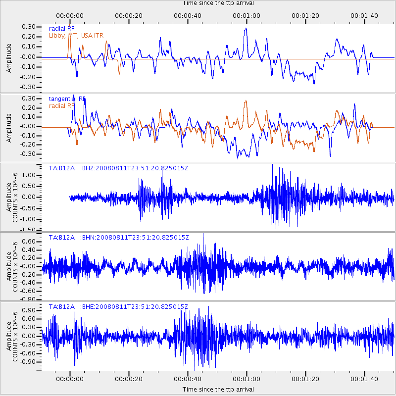
B12A Libby, MT, USA - Earthquake Result Viewer
*The percent match for this event was below the threshold and hence no stack was calculated.
| Earthquake location: |
Central Mid-Atlantic Ridge |
| Earthquake latitude/longitude: |
-1.0/-21.8 |
| Earthquake time(UTC): |
2008/08/11 (224) 23:38:38 GMT |
| Earthquake Depth: |
13 km |
| Earthquake Magnitude: |
6.0 MW, 5.2 MS, 5.4 MB, 6.0 MW |
| Earthquake Catalog/Contributor: |
WHDF/NEIC |
|
| Network: |
TA USArray Transportable Network (new EarthScope stations) |
| Station: |
B12A Libby, MT, USA |
| Lat/Lon: |
48.47 N/115.59 W |
| Elevation: |
764 m |
|
| Distance: |
93.2 deg |
| Az: |
318.305 deg |
| Baz: |
87.877 deg |
| Ray Param: |
$rayparam |
*The percent match for this event was below the threshold and hence was not used in the summary stack. |
|
| Radial Match: |
56.265896 % |
| Radial Bump: |
400 |
| Transverse Match: |
50.958885 % |
| Transverse Bump: |
400 |
| SOD ConfigId: |
2504 |
| Insert Time: |
2010-03-06 15:31:33.028 +0000 |
| GWidth: |
2.5 |
| Max Bumps: |
400 |
| Tol: |
0.001 |
|
Signal To Noise
| Channel | StoN | STA | LTA |
| TA:B12A: :BHN:20080811T23:51:20.825015Z | 1.7031984 | 1.5558403E-7 | 9.1348156E-8 |
| TA:B12A: :BHE:20080811T23:51:20.825015Z | 1.6016436 | 3.3076432E-7 | 2.0651557E-7 |
| TA:B12A: :BHZ:20080811T23:51:20.825015Z | 2.1917825 | 4.0869745E-7 | 1.8646806E-7 |
| Arrivals |
| Ps | |
| PpPs | |
| PsPs/PpSs | |


