You are here: Home > Network List > TA - USArray Transportable Network (new EarthScope stations) Stations List
> Station E18K Tukpahlearik Creek, AK, USA > Earthquake Result Viewer
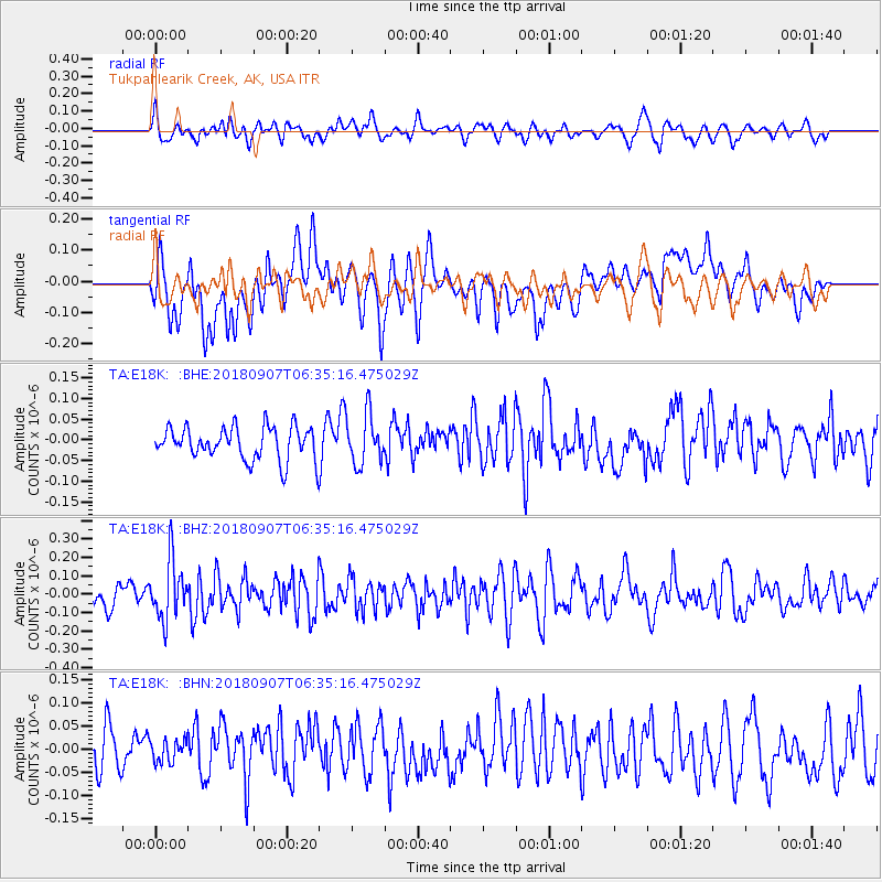
E18K Tukpahlearik Creek, AK, USA - Earthquake Result Viewer
*The percent match for this event was below the threshold and hence no stack was calculated.
| Earthquake location: |
Southern Iran |
| Earthquake latitude/longitude: |
28.3/59.3 |
| Earthquake time(UTC): |
2018/09/07 (250) 06:23:38 GMT |
| Earthquake Depth: |
10 km |
| Earthquake Magnitude: |
5.5 mb |
| Earthquake Catalog/Contributor: |
NEIC PDE/us |
|
| Network: |
TA USArray Transportable Network (new EarthScope stations) |
| Station: |
E18K Tukpahlearik Creek, AK, USA |
| Lat/Lon: |
67.42 N/160.60 W |
| Elevation: |
297 m |
|
| Distance: |
79.9 deg |
| Az: |
14.575 deg |
| Baz: |
324.94 deg |
| Ray Param: |
$rayparam |
*The percent match for this event was below the threshold and hence was not used in the summary stack. |
|
| Radial Match: |
43.94775 % |
| Radial Bump: |
400 |
| Transverse Match: |
58.955933 % |
| Transverse Bump: |
400 |
| SOD ConfigId: |
13570011 |
| Insert Time: |
2019-05-01 04:17:24.788 +0000 |
| GWidth: |
2.5 |
| Max Bumps: |
400 |
| Tol: |
0.001 |
|
Signal To Noise
| Channel | StoN | STA | LTA |
| TA:E18K: :BHZ:20180907T06:35:16.475029Z | 2.7713058 | 1.619064E-7 | 5.842242E-8 |
| TA:E18K: :BHN:20180907T06:35:16.475029Z | 0.44175434 | 2.3971614E-8 | 5.4264582E-8 |
| TA:E18K: :BHE:20180907T06:35:16.475029Z | 1.5040501 | 5.942352E-8 | 3.9509004E-8 |
| Arrivals |
| Ps | |
| PpPs | |
| PsPs/PpSs | |


