You are here: Home > Network List > TA - USArray Transportable Network (new EarthScope stations) Stations List
> Station A13A Flathead National Forest, Polebridge, MT, USA > Earthquake Result Viewer
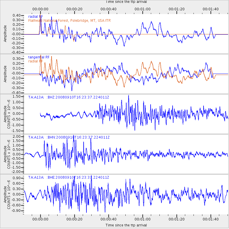
A13A Flathead National Forest, Polebridge, MT, USA - Earthquake Result Viewer
*The percent match for this event was below the threshold and hence no stack was calculated.
| Earthquake location: |
Northern Chile |
| Earthquake latitude/longitude: |
-20.3/-69.2 |
| Earthquake time(UTC): |
2008/09/10 (254) 16:12:04 GMT |
| Earthquake Depth: |
38 km |
| Earthquake Magnitude: |
5.6 MB, 5.3 MS |
| Earthquake Catalog/Contributor: |
WHDF/NEIC |
|
| Network: |
TA USArray Transportable Network (new EarthScope stations) |
| Station: |
A13A Flathead National Forest, Polebridge, MT, USA |
| Lat/Lon: |
48.93 N/114.41 W |
| Elevation: |
1199 m |
|
| Distance: |
79.8 deg |
| Az: |
331.615 deg |
| Baz: |
137.404 deg |
| Ray Param: |
$rayparam |
*The percent match for this event was below the threshold and hence was not used in the summary stack. |
|
| Radial Match: |
72.971 % |
| Radial Bump: |
400 |
| Transverse Match: |
63.90985 % |
| Transverse Bump: |
400 |
| SOD ConfigId: |
2560 |
| Insert Time: |
2010-03-06 15:34:28.228 +0000 |
| GWidth: |
2.5 |
| Max Bumps: |
400 |
| Tol: |
0.001 |
|
Signal To Noise
| Channel | StoN | STA | LTA |
| TA:A13A: :BHN:20080910T16:23:37.224011Z | 4.9407425 | 7.043038E-7 | 1.4255019E-7 |
| TA:A13A: :BHE:20080910T16:23:37.224011Z | 1.2686671 | 1.9717108E-7 | 1.5541592E-7 |
| TA:A13A: :BHZ:20080910T16:23:37.224011Z | 2.0682452 | 2.8775742E-7 | 1.391312E-7 |
| Arrivals |
| Ps | |
| PpPs | |
| PsPs/PpSs | |


