You are here: Home > Network List > AZ - ANZA Regional Network Stations List
> Station SMER AZ.SMER > Earthquake Result Viewer
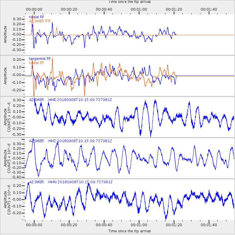
SMER AZ.SMER - Earthquake Result Viewer
*The percent match for this event was below the threshold and hence no stack was calculated.
| Earthquake location: |
Southeast Of Loyalty Islands |
| Earthquake latitude/longitude: |
-22.2/170.2 |
| Earthquake time(UTC): |
2018/09/08 (251) 10:02:49 GMT |
| Earthquake Depth: |
10 km |
| Earthquake Magnitude: |
5.7 Mww |
| Earthquake Catalog/Contributor: |
NEIC PDE/us |
|
| Network: |
AZ ANZA Regional Network |
| Station: |
SMER AZ.SMER |
| Lat/Lon: |
33.46 N/117.17 W |
| Elevation: |
355 m |
|
| Distance: |
88.6 deg |
| Az: |
52.968 deg |
| Baz: |
242.232 deg |
| Ray Param: |
$rayparam |
*The percent match for this event was below the threshold and hence was not used in the summary stack. |
|
| Radial Match: |
50.724197 % |
| Radial Bump: |
400 |
| Transverse Match: |
32.82671 % |
| Transverse Bump: |
400 |
| SOD ConfigId: |
13570011 |
| Insert Time: |
2019-05-01 04:32:15.230 +0000 |
| GWidth: |
2.5 |
| Max Bumps: |
400 |
| Tol: |
0.001 |
|
Signal To Noise
| Channel | StoN | STA | LTA |
| AZ:SMER: :HHZ:20180908T10:15:09.737981Z | 2.1033394 | 2.5295114E-7 | 1.2026167E-7 |
| AZ:SMER: :HHN:20180908T10:15:09.737981Z | 0.8519893 | 8.320416E-8 | 9.7658685E-8 |
| AZ:SMER: :HHE:20180908T10:15:09.737981Z | 0.5852958 | 5.7506476E-8 | 9.825199E-8 |
| Arrivals |
| Ps | |
| PpPs | |
| PsPs/PpSs | |


