You are here: Home > Network List > TA - USArray Transportable Network (new EarthScope stations) Stations List
> Station F20K Avaraart Lake, AK, USA > Earthquake Result Viewer
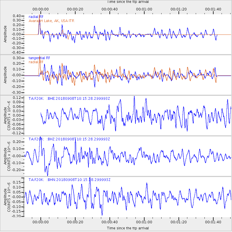
F20K Avaraart Lake, AK, USA - Earthquake Result Viewer
*The percent match for this event was below the threshold and hence no stack was calculated.
| Earthquake location: |
Southeast Of Loyalty Islands |
| Earthquake latitude/longitude: |
-22.2/170.2 |
| Earthquake time(UTC): |
2018/09/08 (251) 10:02:49 GMT |
| Earthquake Depth: |
10 km |
| Earthquake Magnitude: |
5.7 Mww |
| Earthquake Catalog/Contributor: |
NEIC PDE/us |
|
| Network: |
TA USArray Transportable Network (new EarthScope stations) |
| Station: |
F20K Avaraart Lake, AK, USA |
| Lat/Lon: |
67.05 N/155.73 W |
| Elevation: |
136 m |
|
| Distance: |
92.6 deg |
| Az: |
12.722 deg |
| Baz: |
211.353 deg |
| Ray Param: |
$rayparam |
*The percent match for this event was below the threshold and hence was not used in the summary stack. |
|
| Radial Match: |
60.158028 % |
| Radial Bump: |
384 |
| Transverse Match: |
65.96038 % |
| Transverse Bump: |
400 |
| SOD ConfigId: |
13570011 |
| Insert Time: |
2019-05-01 04:35:27.359 +0000 |
| GWidth: |
2.5 |
| Max Bumps: |
400 |
| Tol: |
0.001 |
|
Signal To Noise
| Channel | StoN | STA | LTA |
| TA:F20K: :BHZ:20180908T10:15:28.299993Z | 3.4557087 | 1.7571904E-7 | 5.0848918E-8 |
| TA:F20K: :BHN:20180908T10:15:28.299993Z | 1.2646397 | 5.1202047E-8 | 4.0487457E-8 |
| TA:F20K: :BHE:20180908T10:15:28.299993Z | 1.145954 | 3.511304E-8 | 3.064088E-8 |
| Arrivals |
| Ps | |
| PpPs | |
| PsPs/PpSs | |


