You are here: Home > Network List > TA - USArray Transportable Network (new EarthScope stations) Stations List
> Station M11K Mekoryuk, AK, USA > Earthquake Result Viewer
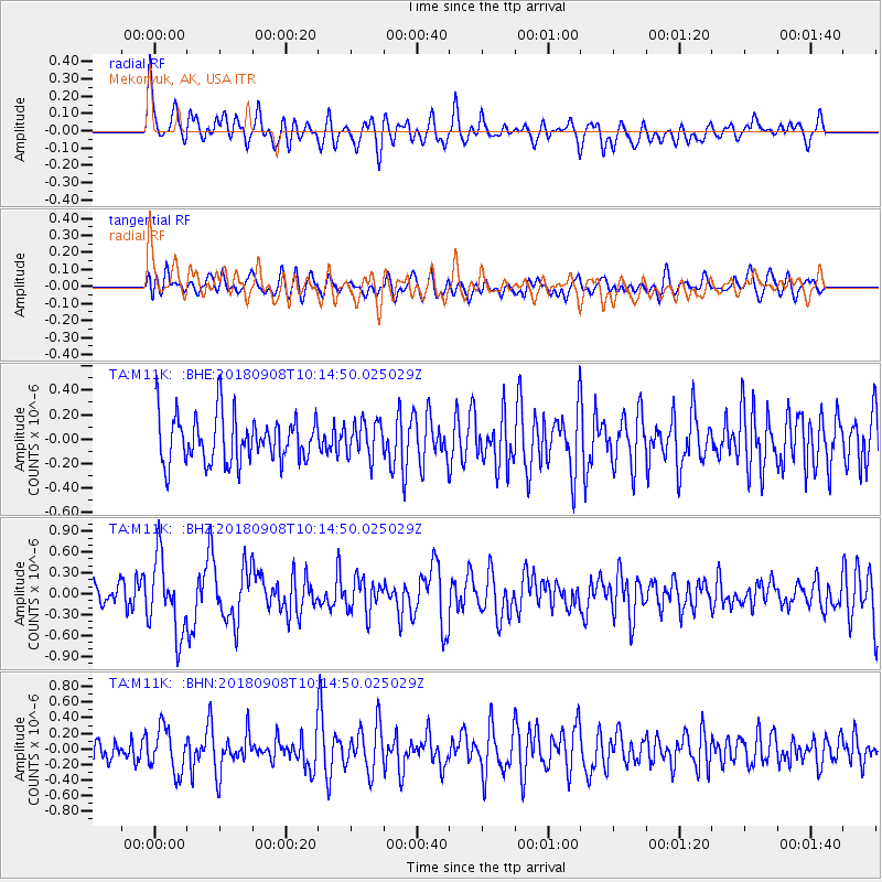
M11K Mekoryuk, AK, USA - Earthquake Result Viewer
*The percent match for this event was below the threshold and hence no stack was calculated.
| Earthquake location: |
Southeast Of Loyalty Islands |
| Earthquake latitude/longitude: |
-22.2/170.2 |
| Earthquake time(UTC): |
2018/09/08 (251) 10:02:49 GMT |
| Earthquake Depth: |
10 km |
| Earthquake Magnitude: |
5.7 Mww |
| Earthquake Catalog/Contributor: |
NEIC PDE/us |
|
| Network: |
TA USArray Transportable Network (new EarthScope stations) |
| Station: |
M11K Mekoryuk, AK, USA |
| Lat/Lon: |
60.38 N/166.20 W |
| Elevation: |
3.0 m |
|
| Distance: |
84.5 deg |
| Az: |
11.544 deg |
| Baz: |
201.922 deg |
| Ray Param: |
$rayparam |
*The percent match for this event was below the threshold and hence was not used in the summary stack. |
|
| Radial Match: |
52.318325 % |
| Radial Bump: |
400 |
| Transverse Match: |
44.9842 % |
| Transverse Bump: |
400 |
| SOD ConfigId: |
13570011 |
| Insert Time: |
2019-05-01 04:36:02.360 +0000 |
| GWidth: |
2.5 |
| Max Bumps: |
400 |
| Tol: |
0.001 |
|
Signal To Noise
| Channel | StoN | STA | LTA |
| TA:M11K: :BHZ:20180908T10:14:50.025029Z | 2.5863388 | 5.4460554E-7 | 2.1057008E-7 |
| TA:M11K: :BHN:20180908T10:14:50.025029Z | 1.271795 | 2.806868E-7 | 2.207013E-7 |
| TA:M11K: :BHE:20180908T10:14:50.025029Z | 0.80826396 | 1.4428274E-7 | 1.7850942E-7 |
| Arrivals |
| Ps | |
| PpPs | |
| PsPs/PpSs | |


