You are here: Home > Network List > TA - USArray Transportable Network (new EarthScope stations) Stations List
> Station A13A Flathead National Forest, Polebridge, MT, USA > Earthquake Result Viewer
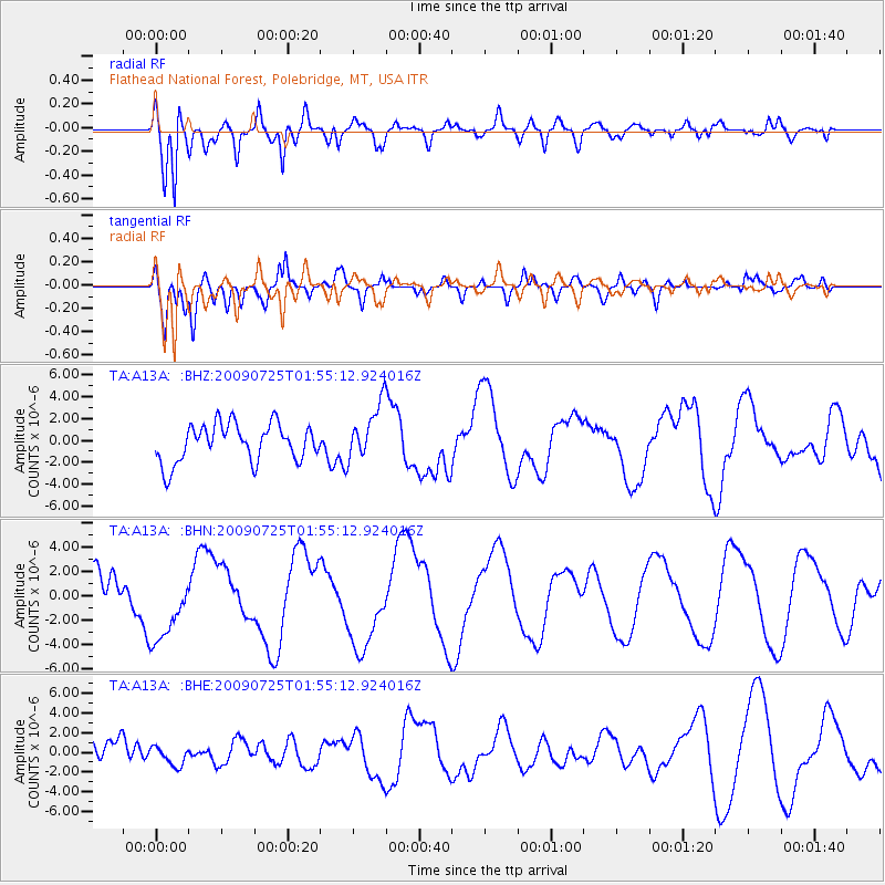
A13A Flathead National Forest, Polebridge, MT, USA - Earthquake Result Viewer
*The percent match for this event was below the threshold and hence no stack was calculated.
| Earthquake location: |
Solomon Islands |
| Earthquake latitude/longitude: |
-6.5/155.0 |
| Earthquake time(UTC): |
2009/07/25 (206) 01:42:23 GMT |
| Earthquake Depth: |
32 km |
| Earthquake Magnitude: |
5.9 MB, 5.7 MS, 5.9 MW, 5.9 MW |
| Earthquake Catalog/Contributor: |
WHDF/NEIC |
|
| Network: |
TA USArray Transportable Network (new EarthScope stations) |
| Station: |
A13A Flathead National Forest, Polebridge, MT, USA |
| Lat/Lon: |
48.93 N/114.41 W |
| Elevation: |
1199 m |
|
| Distance: |
95.2 deg |
| Az: |
41.467 deg |
| Baz: |
266.196 deg |
| Ray Param: |
$rayparam |
*The percent match for this event was below the threshold and hence was not used in the summary stack. |
|
| Radial Match: |
65.22576 % |
| Radial Bump: |
400 |
| Transverse Match: |
60.903305 % |
| Transverse Bump: |
400 |
| SOD ConfigId: |
2648 |
| Insert Time: |
2010-03-06 15:35:05.123 +0000 |
| GWidth: |
2.5 |
| Max Bumps: |
400 |
| Tol: |
0.001 |
|
Signal To Noise
| Channel | StoN | STA | LTA |
| TA:A13A: :BHN:20090725T01:55:12.924016Z | 1.9429219 | 3.0286578E-6 | 1.5588162E-6 |
| TA:A13A: :BHE:20090725T01:55:12.924016Z | 0.7000442 | 9.83705E-7 | 1.4052041E-6 |
| TA:A13A: :BHZ:20090725T01:55:12.924016Z | 1.4760805 | 2.5606712E-6 | 1.7347776E-6 |
| Arrivals |
| Ps | |
| PpPs | |
| PsPs/PpSs | |


