You are here: Home > Network List > IU - Global Seismograph Network (GSN - IRIS/USGS) Stations List
> Station XMAS Kiritimati Island, Republic of Kiribati > Earthquake Result Viewer
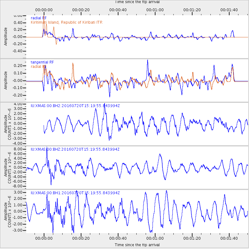
XMAS Kiritimati Island, Republic of Kiribati - Earthquake Result Viewer
*The percent match for this event was below the threshold and hence no stack was calculated.
| Earthquake location: |
Vanuatu Islands |
| Earthquake latitude/longitude: |
-18.9/169.0 |
| Earthquake time(UTC): |
2016/07/20 (202) 15:13:16 GMT |
| Earthquake Depth: |
164 km |
| Earthquake Magnitude: |
6.0 MO |
| Earthquake Catalog/Contributor: |
NEIC PDE/NEIC ALERT |
|
| Network: |
IU Global Seismograph Network (GSN - IRIS/USGS) |
| Station: |
XMAS Kiritimati Island, Republic of Kiribati |
| Lat/Lon: |
2.04 N/157.45 W |
| Elevation: |
20 m |
|
| Distance: |
39.0 deg |
| Az: |
61.331 deg |
| Baz: |
236.223 deg |
| Ray Param: |
$rayparam |
*The percent match for this event was below the threshold and hence was not used in the summary stack. |
|
| Radial Match: |
33.512844 % |
| Radial Bump: |
400 |
| Transverse Match: |
64.79424 % |
| Transverse Bump: |
400 |
| SOD ConfigId: |
1634031 |
| Insert Time: |
2016-08-03 15:17:37.193 +0000 |
| GWidth: |
2.5 |
| Max Bumps: |
400 |
| Tol: |
0.001 |
|
Signal To Noise
| Channel | StoN | STA | LTA |
| IU:XMAS:00:BHZ:20160720T15:19:55.843994Z | 3.2757757 | 3.2814853E-6 | 1.0017429E-6 |
| IU:XMAS:00:BH1:20160720T15:19:55.843994Z | 1.1509484 | 1.1629254E-6 | 1.0104062E-6 |
| IU:XMAS:00:BH2:20160720T15:19:55.843994Z | 2.1072505 | 1.8988084E-6 | 9.0108335E-7 |
| Arrivals |
| Ps | |
| PpPs | |
| PsPs/PpSs | |


