You are here: Home > Network List > TA - USArray Transportable Network (new EarthScope stations) Stations List
> Station A13A Flathead National Forest, Polebridge, MT, USA > Earthquake Result Viewer
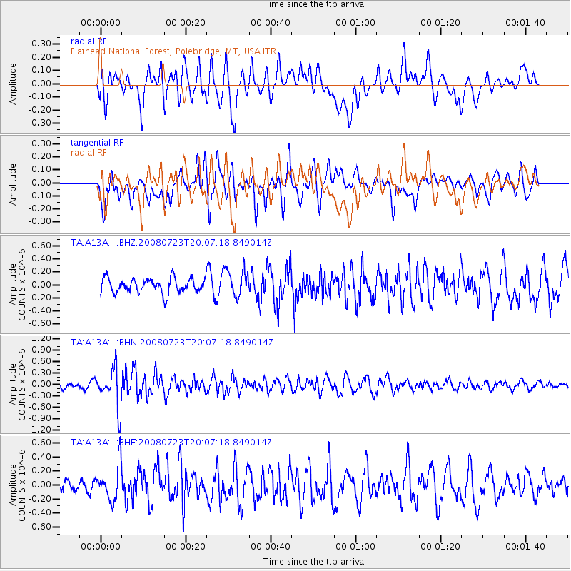
A13A Flathead National Forest, Polebridge, MT, USA - Earthquake Result Viewer
*The percent match for this event was below the threshold and hence no stack was calculated.
| Earthquake location: |
Sichuan, China |
| Earthquake latitude/longitude: |
32.7/105.5 |
| Earthquake time(UTC): |
2008/07/23 (205) 19:54:45 GMT |
| Earthquake Depth: |
10 km |
| Earthquake Magnitude: |
5.7 MB, 5.2 MS, 5.5 MW, 5.5 MW |
| Earthquake Catalog/Contributor: |
WHDF/NEIC |
|
| Network: |
TA USArray Transportable Network (new EarthScope stations) |
| Station: |
A13A Flathead National Forest, Polebridge, MT, USA |
| Lat/Lon: |
48.93 N/114.41 W |
| Elevation: |
1199 m |
|
| Distance: |
91.2 deg |
| Az: |
25.036 deg |
| Baz: |
327.262 deg |
| Ray Param: |
$rayparam |
*The percent match for this event was below the threshold and hence was not used in the summary stack. |
|
| Radial Match: |
66.35122 % |
| Radial Bump: |
400 |
| Transverse Match: |
57.01644 % |
| Transverse Bump: |
400 |
| SOD ConfigId: |
2504 |
| Insert Time: |
2010-03-06 15:35:27.636 +0000 |
| GWidth: |
2.5 |
| Max Bumps: |
400 |
| Tol: |
0.001 |
|
Signal To Noise
| Channel | StoN | STA | LTA |
| TA:A13A: :BHN:20080723T20:07:18.849014Z | 3.648516 | 5.1570726E-7 | 1.4134713E-7 |
| TA:A13A: :BHE:20080723T20:07:18.849014Z | 2.2082357 | 2.649372E-7 | 1.1997687E-7 |
| TA:A13A: :BHZ:20080723T20:07:18.849014Z | 1.8486192 | 2.0674669E-7 | 1.1183844E-7 |
| Arrivals |
| Ps | |
| PpPs | |
| PsPs/PpSs | |


