You are here: Home > Network List > TA - USArray Transportable Network (new EarthScope stations) Stations List
> Station A13A Flathead National Forest, Polebridge, MT, USA > Earthquake Result Viewer
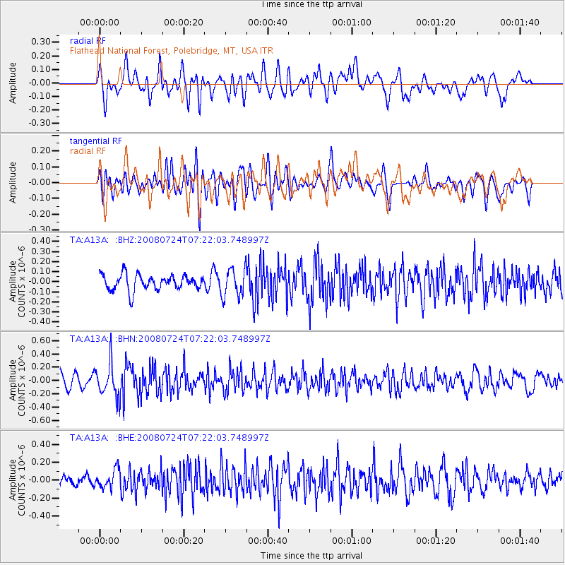
A13A Flathead National Forest, Polebridge, MT, USA - Earthquake Result Viewer
*The percent match for this event was below the threshold and hence no stack was calculated.
| Earthquake location: |
Sichuan, China |
| Earthquake latitude/longitude: |
32.7/105.5 |
| Earthquake time(UTC): |
2008/07/24 (206) 07:09:30 GMT |
| Earthquake Depth: |
10 km |
| Earthquake Magnitude: |
5.6 MB, 5.4 MS, 5.7 MW, 5.6 MW |
| Earthquake Catalog/Contributor: |
WHDF/NEIC |
|
| Network: |
TA USArray Transportable Network (new EarthScope stations) |
| Station: |
A13A Flathead National Forest, Polebridge, MT, USA |
| Lat/Lon: |
48.93 N/114.41 W |
| Elevation: |
1199 m |
|
| Distance: |
91.2 deg |
| Az: |
25.061 deg |
| Baz: |
327.227 deg |
| Ray Param: |
$rayparam |
*The percent match for this event was below the threshold and hence was not used in the summary stack. |
|
| Radial Match: |
54.144447 % |
| Radial Bump: |
400 |
| Transverse Match: |
47.60997 % |
| Transverse Bump: |
400 |
| SOD ConfigId: |
2504 |
| Insert Time: |
2010-03-06 15:35:28.356 +0000 |
| GWidth: |
2.5 |
| Max Bumps: |
400 |
| Tol: |
0.001 |
|
Signal To Noise
| Channel | StoN | STA | LTA |
| TA:A13A: :BHN:20080724T07:22:03.748997Z | 2.4968174 | 2.5231998E-7 | 1.0105664E-7 |
| TA:A13A: :BHE:20080724T07:22:03.748997Z | 1.4311935 | 1.03454155E-7 | 7.228523E-8 |
| TA:A13A: :BHZ:20080724T07:22:03.748997Z | 1.8491246 | 1.4276536E-7 | 7.7207005E-8 |
| Arrivals |
| Ps | |
| PpPs | |
| PsPs/PpSs | |


