You are here: Home > Network List > AV - Alaska Volcano Observatory Stations List
> Station SPCR Ckakachatna River, Mount Spurr, Alaska > Earthquake Result Viewer
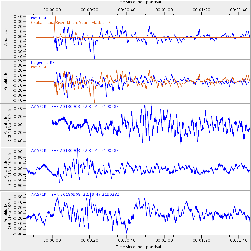
SPCR Ckakachatna River, Mount Spurr, Alaska - Earthquake Result Viewer
*The percent match for this event was below the threshold and hence no stack was calculated.
| Earthquake location: |
South Of Tonga Islands |
| Earthquake latitude/longitude: |
-24.5/-175.6 |
| Earthquake time(UTC): |
2018/09/08 (251) 22:27:27 GMT |
| Earthquake Depth: |
10 km |
| Earthquake Magnitude: |
5.5 Mww |
| Earthquake Catalog/Contributor: |
NEIC PDE/us |
|
| Network: |
AV Alaska Volcano Observatory |
| Station: |
SPCR Ckakachatna River, Mount Spurr, Alaska |
| Lat/Lon: |
61.20 N/152.21 W |
| Elevation: |
984 m |
|
| Distance: |
87.4 deg |
| Az: |
11.079 deg |
| Baz: |
201.198 deg |
| Ray Param: |
$rayparam |
*The percent match for this event was below the threshold and hence was not used in the summary stack. |
|
| Radial Match: |
61.907684 % |
| Radial Bump: |
377 |
| Transverse Match: |
71.99529 % |
| Transverse Bump: |
400 |
| SOD ConfigId: |
13570011 |
| Insert Time: |
2019-05-01 04:39:47.295 +0000 |
| GWidth: |
2.5 |
| Max Bumps: |
400 |
| Tol: |
0.001 |
|
Signal To Noise
| Channel | StoN | STA | LTA |
| AV:SPCR: :BHZ:20180908T22:39:45.219028Z | 2.3237028 | 3.6718254E-7 | 1.5801612E-7 |
| AV:SPCR: :BHN:20180908T22:39:45.219028Z | 2.1504292 | 3.1094703E-7 | 1.4459766E-7 |
| AV:SPCR: :BHE:20180908T22:39:45.219028Z | 1.3231883 | 1.1623533E-7 | 8.784488E-8 |
| Arrivals |
| Ps | |
| PpPs | |
| PsPs/PpSs | |


