You are here: Home > Network List > TA - USArray Transportable Network (new EarthScope stations) Stations List
> Station A13A Flathead National Forest, Polebridge, MT, USA > Earthquake Result Viewer
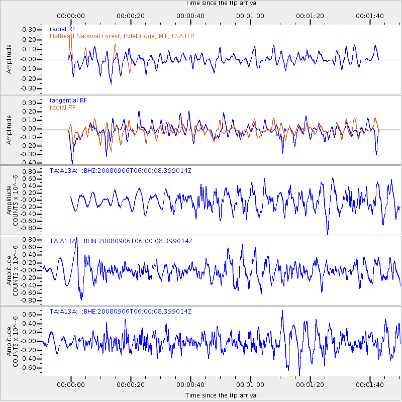
A13A Flathead National Forest, Polebridge, MT, USA - Earthquake Result Viewer
*The percent match for this event was below the threshold and hence no stack was calculated.
| Earthquake location: |
Hindu Kush Region, Afghanistan |
| Earthquake latitude/longitude: |
36.5/70.9 |
| Earthquake time(UTC): |
2008/09/06 (250) 05:47:39 GMT |
| Earthquake Depth: |
192 km |
| Earthquake Magnitude: |
5.5 MB, 5.8 MW, 5.8 MW |
| Earthquake Catalog/Contributor: |
WHDF/NEIC |
|
| Network: |
TA USArray Transportable Network (new EarthScope stations) |
| Station: |
A13A Flathead National Forest, Polebridge, MT, USA |
| Lat/Lon: |
48.93 N/114.41 W |
| Elevation: |
1199 m |
|
| Distance: |
94.8 deg |
| Az: |
3.536 deg |
| Baz: |
355.677 deg |
| Ray Param: |
$rayparam |
*The percent match for this event was below the threshold and hence was not used in the summary stack. |
|
| Radial Match: |
34.9709 % |
| Radial Bump: |
400 |
| Transverse Match: |
54.79283 % |
| Transverse Bump: |
400 |
| SOD ConfigId: |
2560 |
| Insert Time: |
2010-03-06 15:35:37.014 +0000 |
| GWidth: |
2.5 |
| Max Bumps: |
400 |
| Tol: |
0.001 |
|
Signal To Noise
| Channel | StoN | STA | LTA |
| TA:A13A: :BHN:20080906T06:00:08.399014Z | 2.319563 | 4.6721698E-7 | 2.0142458E-7 |
| TA:A13A: :BHE:20080906T06:00:08.399014Z | 0.34054774 | 9.111177E-8 | 2.675448E-7 |
| TA:A13A: :BHZ:20080906T06:00:08.399014Z | 1.2843584 | 2.0829529E-7 | 1.6217848E-7 |
| Arrivals |
| Ps | |
| PpPs | |
| PsPs/PpSs | |


