You are here: Home > Network List > CI - Caltech Regional Seismic Network Stations List
> Station SMM Simmler, CA, USA > Earthquake Result Viewer
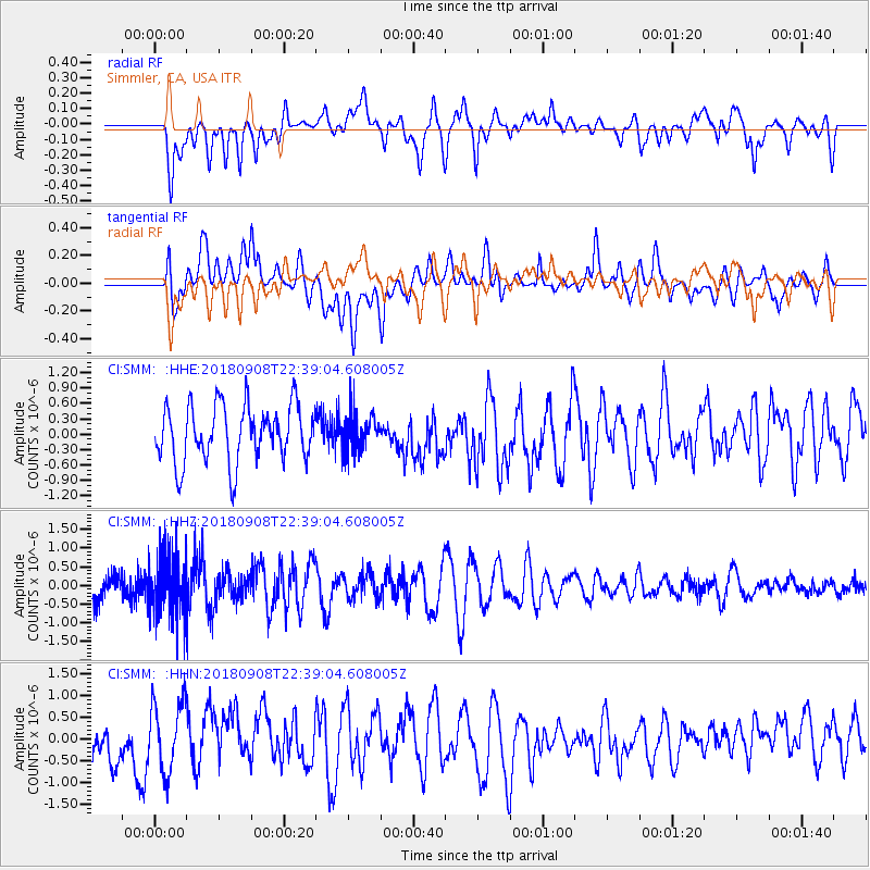
SMM Simmler, CA, USA - Earthquake Result Viewer
*The percent match for this event was below the threshold and hence no stack was calculated.
| Earthquake location: |
South Of Tonga Islands |
| Earthquake latitude/longitude: |
-24.5/-175.6 |
| Earthquake time(UTC): |
2018/09/08 (251) 22:27:27 GMT |
| Earthquake Depth: |
10 km |
| Earthquake Magnitude: |
5.5 Mww |
| Earthquake Catalog/Contributor: |
NEIC PDE/us |
|
| Network: |
CI Caltech Regional Seismic Network |
| Station: |
SMM Simmler, CA, USA |
| Lat/Lon: |
35.31 N/120.00 W |
| Elevation: |
599 m |
|
| Distance: |
79.4 deg |
| Az: |
43.337 deg |
| Baz: |
229.877 deg |
| Ray Param: |
$rayparam |
*The percent match for this event was below the threshold and hence was not used in the summary stack. |
|
| Radial Match: |
44.931583 % |
| Radial Bump: |
400 |
| Transverse Match: |
47.70228 % |
| Transverse Bump: |
400 |
| SOD ConfigId: |
13570011 |
| Insert Time: |
2019-05-01 04:40:59.482 +0000 |
| GWidth: |
2.5 |
| Max Bumps: |
400 |
| Tol: |
0.001 |
|
Signal To Noise
| Channel | StoN | STA | LTA |
| CI:SMM: :HHZ:20180908T22:39:04.608005Z | 1.9644254 | 8.4446646E-7 | 4.298796E-7 |
| CI:SMM: :HHN:20180908T22:39:04.608005Z | 0.94916165 | 7.853009E-7 | 8.273627E-7 |
| CI:SMM: :HHE:20180908T22:39:04.608005Z | 0.6885795 | 3.8882632E-7 | 5.646789E-7 |
| Arrivals |
| Ps | |
| PpPs | |
| PsPs/PpSs | |


