You are here: Home > Network List > US - United States National Seismic Network Stations List
> Station MSO Missoula, Montana, USA > Earthquake Result Viewer
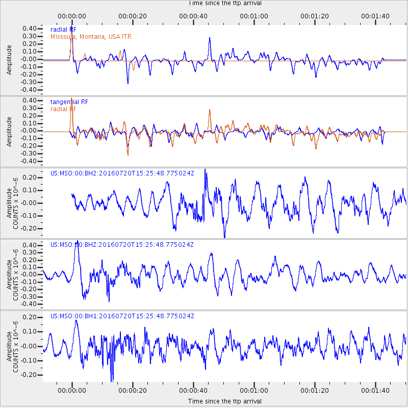
MSO Missoula, Montana, USA - Earthquake Result Viewer
*The percent match for this event was below the threshold and hence no stack was calculated.
| Earthquake location: |
Vanuatu Islands |
| Earthquake latitude/longitude: |
-18.9/169.0 |
| Earthquake time(UTC): |
2016/07/20 (202) 15:13:16 GMT |
| Earthquake Depth: |
164 km |
| Earthquake Magnitude: |
6.0 MO |
| Earthquake Catalog/Contributor: |
NEIC PDE/NEIC ALERT |
|
| Network: |
US United States National Seismic Network |
| Station: |
MSO Missoula, Montana, USA |
| Lat/Lon: |
46.83 N/113.94 W |
| Elevation: |
1264 m |
|
| Distance: |
95.1 deg |
| Az: |
42.2 deg |
| Baz: |
247.851 deg |
| Ray Param: |
$rayparam |
*The percent match for this event was below the threshold and hence was not used in the summary stack. |
|
| Radial Match: |
68.67821 % |
| Radial Bump: |
400 |
| Transverse Match: |
61.73128 % |
| Transverse Bump: |
400 |
| SOD ConfigId: |
1634031 |
| Insert Time: |
2016-08-03 15:19:36.264 +0000 |
| GWidth: |
2.5 |
| Max Bumps: |
400 |
| Tol: |
0.001 |
|
Signal To Noise
| Channel | StoN | STA | LTA |
| US:MSO:00:BHZ:20160720T15:25:48.775024Z | 5.492224 | 2.541158E-7 | 4.6268283E-8 |
| US:MSO:00:BH1:20160720T15:25:48.775024Z | 1.9809256 | 1.0070196E-7 | 5.0835812E-8 |
| US:MSO:00:BH2:20160720T15:25:48.775024Z | 2.4843526 | 1.2029729E-7 | 4.8421988E-8 |
| Arrivals |
| Ps | |
| PpPs | |
| PsPs/PpSs | |


