You are here: Home > Network List > TA - USArray Transportable Network (new EarthScope stations) Stations List
> Station M31M Drury Creek, Yukon, CA > Earthquake Result Viewer
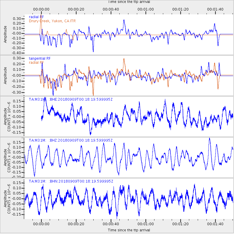
M31M Drury Creek, Yukon, CA - Earthquake Result Viewer
*The percent match for this event was below the threshold and hence no stack was calculated.
| Earthquake location: |
South Of Fiji Islands |
| Earthquake latitude/longitude: |
-25.0/179.9 |
| Earthquake time(UTC): |
2018/09/09 (252) 00:06:23 GMT |
| Earthquake Depth: |
479 km |
| Earthquake Magnitude: |
5.5 Mww |
| Earthquake Catalog/Contributor: |
NEIC PDE/us |
|
| Network: |
TA USArray Transportable Network (new EarthScope stations) |
| Station: |
M31M Drury Creek, Yukon, CA |
| Lat/Lon: |
62.20 N/134.39 W |
| Elevation: |
639 m |
|
| Distance: |
94.3 deg |
| Az: |
19.649 deg |
| Baz: |
220.596 deg |
| Ray Param: |
$rayparam |
*The percent match for this event was below the threshold and hence was not used in the summary stack. |
|
| Radial Match: |
44.975616 % |
| Radial Bump: |
400 |
| Transverse Match: |
54.919827 % |
| Transverse Bump: |
400 |
| SOD ConfigId: |
13570011 |
| Insert Time: |
2019-05-01 04:51:12.857 +0000 |
| GWidth: |
2.5 |
| Max Bumps: |
400 |
| Tol: |
0.001 |
|
Signal To Noise
| Channel | StoN | STA | LTA |
| TA:M31M: :BHZ:20180909T00:18:19.599995Z | 0.9365059 | 6.706743E-8 | 7.161454E-8 |
| TA:M31M: :BHN:20180909T00:18:19.599995Z | 1.1682029 | 7.660913E-8 | 6.557862E-8 |
| TA:M31M: :BHE:20180909T00:18:19.599995Z | 1.5362197 | 8.5234895E-8 | 5.5483532E-8 |
| Arrivals |
| Ps | |
| PpPs | |
| PsPs/PpSs | |


