You are here: Home > Network List > TA - USArray Transportable Network (new EarthScope stations) Stations List
> Station P17K Kvichak River, AK, USA > Earthquake Result Viewer
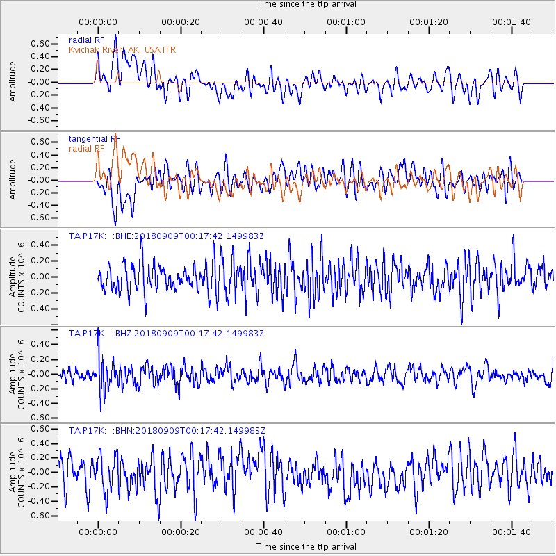
P17K Kvichak River, AK, USA - Earthquake Result Viewer
*The percent match for this event was below the threshold and hence no stack was calculated.
| Earthquake location: |
South Of Fiji Islands |
| Earthquake latitude/longitude: |
-25.0/179.9 |
| Earthquake time(UTC): |
2018/09/09 (252) 00:06:23 GMT |
| Earthquake Depth: |
479 km |
| Earthquake Magnitude: |
5.5 Mww |
| Earthquake Catalog/Contributor: |
NEIC PDE/us |
|
| Network: |
TA USArray Transportable Network (new EarthScope stations) |
| Station: |
P17K Kvichak River, AK, USA |
| Lat/Lon: |
59.20 N/156.44 W |
| Elevation: |
91 m |
|
| Distance: |
86.1 deg |
| Az: |
11.926 deg |
| Baz: |
201.363 deg |
| Ray Param: |
$rayparam |
*The percent match for this event was below the threshold and hence was not used in the summary stack. |
|
| Radial Match: |
46.852673 % |
| Radial Bump: |
400 |
| Transverse Match: |
45.29218 % |
| Transverse Bump: |
400 |
| SOD ConfigId: |
13570011 |
| Insert Time: |
2019-05-01 04:51:18.531 +0000 |
| GWidth: |
2.5 |
| Max Bumps: |
400 |
| Tol: |
0.001 |
|
Signal To Noise
| Channel | StoN | STA | LTA |
| TA:P17K: :BHZ:20180909T00:17:42.149983Z | 2.8180609 | 2.2937296E-7 | 8.13939E-8 |
| TA:P17K: :BHN:20180909T00:17:42.149983Z | 1.2222944 | 2.445724E-7 | 2.0009286E-7 |
| TA:P17K: :BHE:20180909T00:17:42.149983Z | 1.414044 | 2.1765887E-7 | 1.539265E-7 |
| Arrivals |
| Ps | |
| PpPs | |
| PsPs/PpSs | |


