You are here: Home > Network List > AV - Alaska Volcano Observatory Stations List
> Station SPCR Ckakachatna River, Mount Spurr, Alaska > Earthquake Result Viewer
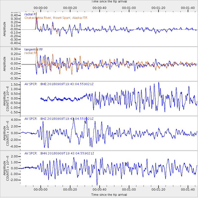
SPCR Ckakachatna River, Mount Spurr, Alaska - Earthquake Result Viewer
*The percent match for this event was below the threshold and hence no stack was calculated.
| Earthquake location: |
Solomon Islands |
| Earthquake latitude/longitude: |
-10.1/161.6 |
| Earthquake time(UTC): |
2018/09/09 (252) 19:31:36 GMT |
| Earthquake Depth: |
54 km |
| Earthquake Magnitude: |
6.7 Mi |
| Earthquake Catalog/Contributor: |
NEIC PDE/at |
|
| Network: |
AV Alaska Volcano Observatory |
| Station: |
SPCR Ckakachatna River, Mount Spurr, Alaska |
| Lat/Lon: |
61.20 N/152.21 W |
| Elevation: |
984 m |
|
| Distance: |
79.8 deg |
| Az: |
20.799 deg |
| Baz: |
226.228 deg |
| Ray Param: |
$rayparam |
*The percent match for this event was below the threshold and hence was not used in the summary stack. |
|
| Radial Match: |
91.52012 % |
| Radial Bump: |
400 |
| Transverse Match: |
88.63296 % |
| Transverse Bump: |
400 |
| SOD ConfigId: |
13570011 |
| Insert Time: |
2019-05-01 04:55:43.290 +0000 |
| GWidth: |
2.5 |
| Max Bumps: |
400 |
| Tol: |
0.001 |
|
Signal To Noise
| Channel | StoN | STA | LTA |
| AV:SPCR: :BHZ:20180909T19:43:04.559021Z | 10.818087 | 2.1265096E-6 | 1.9656984E-7 |
| AV:SPCR: :BHN:20180909T19:43:04.559021Z | 4.435785 | 6.822858E-7 | 1.53814E-7 |
| AV:SPCR: :BHE:20180909T19:43:04.559021Z | 4.3146014 | 4.7381957E-7 | 1.09817684E-7 |
| Arrivals |
| Ps | |
| PpPs | |
| PsPs/PpSs | |


