You are here: Home > Network List > TA - USArray Transportable Network (new EarthScope stations) Stations List
> Station R33M Jennings River, BC, CAN > Earthquake Result Viewer
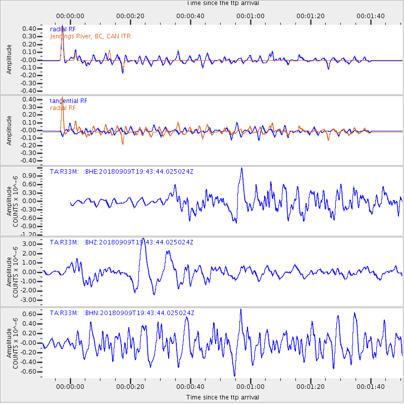
R33M Jennings River, BC, CAN - Earthquake Result Viewer
*The percent match for this event was below the threshold and hence no stack was calculated.
| Earthquake location: |
Solomon Islands |
| Earthquake latitude/longitude: |
-10.1/161.6 |
| Earthquake time(UTC): |
2018/09/09 (252) 19:31:36 GMT |
| Earthquake Depth: |
54 km |
| Earthquake Magnitude: |
6.7 Mi |
| Earthquake Catalog/Contributor: |
NEIC PDE/at |
|
| Network: |
TA USArray Transportable Network (new EarthScope stations) |
| Station: |
R33M Jennings River, BC, CAN |
| Lat/Lon: |
59.39 N/130.97 W |
| Elevation: |
1437 m |
|
| Distance: |
87.5 deg |
| Az: |
28.225 deg |
| Baz: |
245.529 deg |
| Ray Param: |
$rayparam |
*The percent match for this event was below the threshold and hence was not used in the summary stack. |
|
| Radial Match: |
89.19441 % |
| Radial Bump: |
400 |
| Transverse Match: |
69.02986 % |
| Transverse Bump: |
400 |
| SOD ConfigId: |
13570011 |
| Insert Time: |
2019-05-01 05:02:23.332 +0000 |
| GWidth: |
2.5 |
| Max Bumps: |
400 |
| Tol: |
0.001 |
|
Signal To Noise
| Channel | StoN | STA | LTA |
| TA:R33M: :BHZ:20180909T19:43:44.025024Z | 6.584397 | 8.5780067E-7 | 1.302778E-7 |
| TA:R33M: :BHN:20180909T19:43:44.025024Z | 1.4778404 | 1.3926913E-7 | 9.4238274E-8 |
| TA:R33M: :BHE:20180909T19:43:44.025024Z | 3.2959006 | 2.8080098E-7 | 8.519704E-8 |
| Arrivals |
| Ps | |
| PpPs | |
| PsPs/PpSs | |


