
E14A Clinton, MT, USA - Earthquake Result Viewer
| ||||||||||||||||||
| ||||||||||||||||||
| ||||||||||||||||||
|
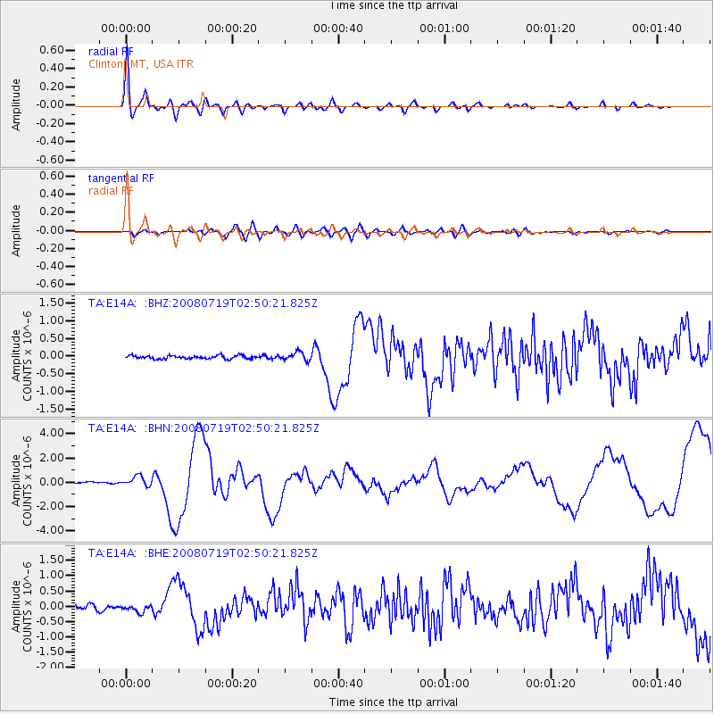
Signal To Noise
| Channel | StoN | STA | LTA |
| TA:E14A: :BHN:20080719T02:50:21.825Z | 5.425942 | 4.1046528E-7 | 7.564867E-8 |
| TA:E14A: :BHE:20080719T02:50:21.825Z | 2.0296452 | 1.3006816E-7 | 6.408419E-8 |
| TA:E14A: :BHZ:20080719T02:50:21.825Z | 2.5276716 | 1.1506023E-7 | 4.5520245E-8 |
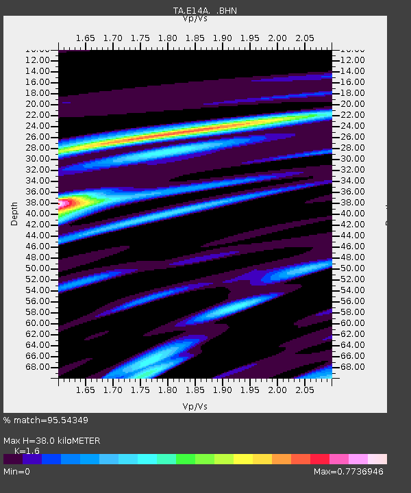
| Arrivals | |
| Ps | 3.7 SECOND |
| PpPs | 15 SECOND |
| PsPs/PpSs | 19 SECOND |

