E14A Clinton, MT, USA - Earthquake Result Viewer
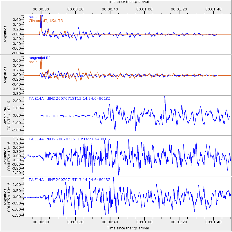
Earthquake location: Fox Islands, Aleutian Islands
Earthquake latitude/longitude: 52.5/-168.0
Earthquake time(UTC): 2007/07/15 (196) 13:08:00 GMT
Earthquake Depth: 10 km
Earthquake Magnitude: 5.8 MB, 5.9 MS, 6.1 MW, 6.0 MW
Earthquake Catalog/Contributor: WHDF/NEIC
Network: TA USArray Transportable Network (new EarthScope stations)
Station: E14A Clinton, MT, USA
Lat/Lon: 46.42 N/113.49 W
Elevation: 1675 m
Distance: 35.2 deg
Az: 77.573 deg
Baz: 300.306 deg
Ray Param: 0.07732197
Estimated Moho Depth: 16.75 km
Estimated Crust Vp/Vs: 1.98
Assumed Crust Vp: 6.353 km/s
Estimated Crust Vs: 3.217 km/s
Estimated Crust Poisson's Ratio: 0.33
Radial Match: 86.18035 %
Radial Bump: 400
Transverse Match: 80.66712 %
Transverse Bump: 400
SOD ConfigId: 2564
Insert Time: 2010-03-06 15:42:37.485 +0000
GWidth: 2.5
Max Bumps: 400
Tol: 0.001

Signal To Noise

ChannelStoNSTALTA
TA:E14A: :BHN:20070715T13:14:24.648013Z2.4964831.5941784E-76.3856966E-8
TA:E14A: :BHE:20070715T13:14:24.648013Z2.3109461.4045513E-76.07782E-8
TA:E14A: :BHZ:20070715T13:14:24.648013Z8.1611573.5767795E-74.382687E-8
Arrivals
Ps2.7 SECOND
PpPs7.3 SECOND
PsPs/PpSs10 SECOND