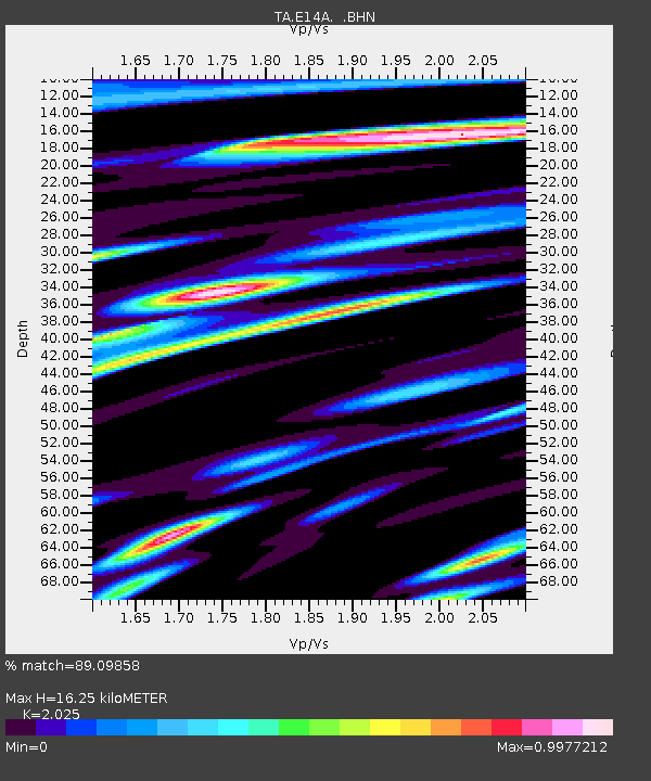
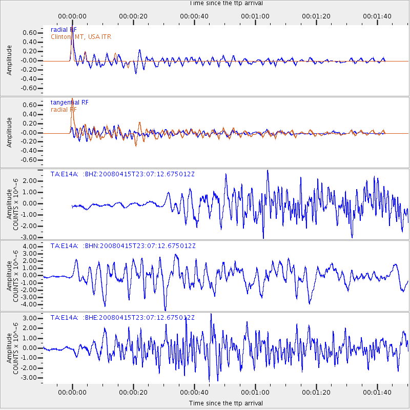
E14A Clinton, MT, USA - Earthquake Result Viewer

Earthquake location: Andreanof Islands, Aleutian Is.
Earthquake latitude/longitude: 51.9/-179.4
Earthquake time(UTC): 2008/04/15 (106) 22:59:51 GMT
Earthquake Depth: 10 km
Earthquake Magnitude: 6.1 MB, 6.4 MS, 6.4 MW, 6.4 MW
Earthquake Catalog/Contributor: WHDF/NEIC
Network: TA USArray Transportable Network (new EarthScope stations)
Station: E14A Clinton, MT, USA
Lat/Lon: 46.42 N/113.49 W
Elevation: 1675 m
Distance: 42.1 deg
Az: 70.31 deg
Baz: 302.427 deg
Ray Param: 0.073362894
Estimated Moho Depth: 16.25 km
Estimated Crust Vp/Vs: 2.03
Assumed Crust Vp: 6.353 km/s
Estimated Crust Vs: 3.137 km/s
Estimated Crust Poisson's Ratio: 0.34
Radial Match: 89.09858 %
Radial Bump: 400
Transverse Match: 79.66041 %
Transverse Bump: 400
SOD ConfigId: 2504
Insert Time: 2010-03-06 15:42:57.751 +0000
GWidth: 2.5
Max Bumps: 400
Tol: 0.001

Signal To Noise

ChannelStoNSTALTA
TA:E14A: :BHN:20080415T23:07:12.675012Z10.6286759.896579E-79.3112064E-8
TA:E14A: :BHE:20080415T23:07:12.675012Z2.2684723.1802207E-71.401922E-7
TA:E14A: :BHZ:20080415T23:07:12.675012Z3.58392835.1625227E-71.4404648E-7
Arrivals
Ps2.8 SECOND
PpPs7.3 SECOND
PsPs/PpSs10 SECOND