
E14A Clinton, MT, USA - Earthquake Result Viewer
| ||||||||||||||||||
| ||||||||||||||||||
| ||||||||||||||||||
|
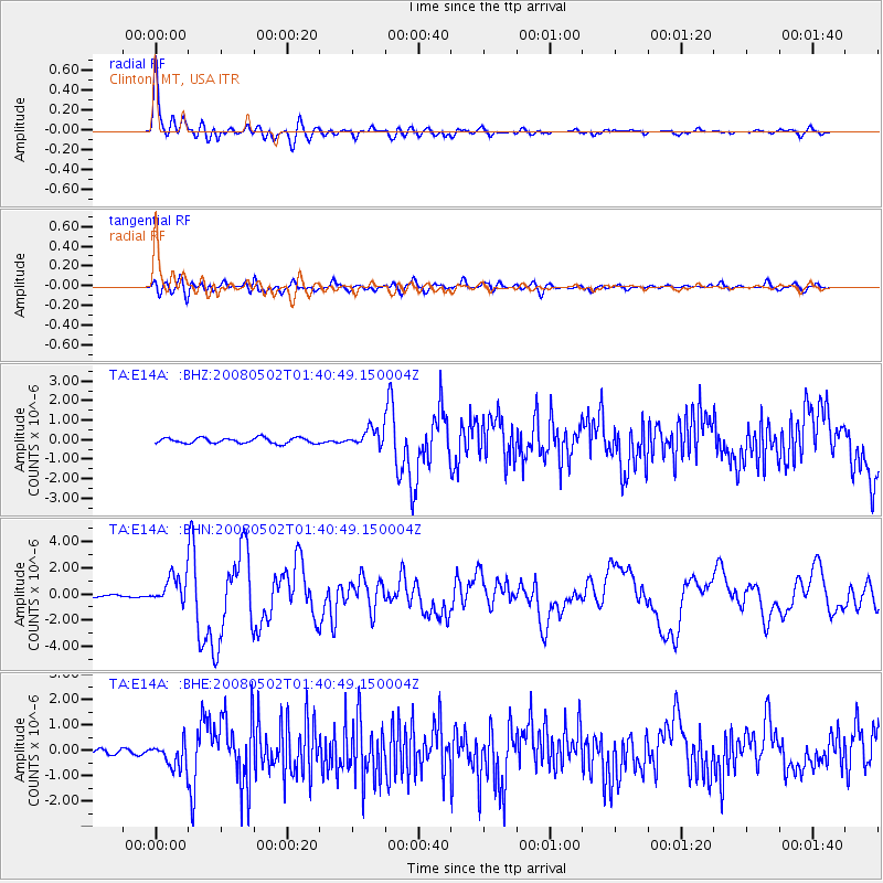
Signal To Noise
| Channel | StoN | STA | LTA |
| TA:E14A: :BHN:20080502T01:40:49.150004Z | 9.338246 | 1.0994946E-6 | 1.1774102E-7 |
| TA:E14A: :BHE:20080502T01:40:49.150004Z | 4.5077615 | 5.090159E-7 | 1.1291988E-7 |
| TA:E14A: :BHZ:20080502T01:40:49.150004Z | 3.24332 | 4.562715E-7 | 1.4068038E-7 |
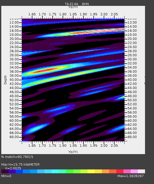
| Arrivals | |
| Ps | 2.6 SECOND |
| PpPs | 7.0 SECOND |
| PsPs/PpSs | 9.7 SECOND |

