You are here: Home > Network List > TA - USArray Transportable Network (new EarthScope stations) Stations List
> Station E14A Clinton, MT, USA > Earthquake Result Viewer
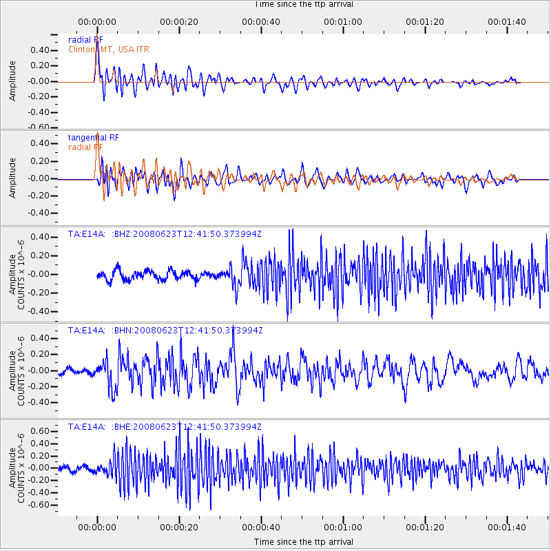
E14A Clinton, MT, USA - Earthquake Result Viewer
*The percent match for this event was below the threshold and hence no stack was calculated.
| Earthquake location: |
Kuril Islands |
| Earthquake latitude/longitude: |
46.5/153.3 |
| Earthquake time(UTC): |
2008/06/23 (175) 12:32:12 GMT |
| Earthquake Depth: |
10 km |
| Earthquake Magnitude: |
5.6 MB, 5.2 MS, 5.6 MW, 5.6 MW |
| Earthquake Catalog/Contributor: |
WHDF/NEIC |
|
| Network: |
TA USArray Transportable Network (new EarthScope stations) |
| Station: |
E14A Clinton, MT, USA |
| Lat/Lon: |
46.42 N/113.49 W |
| Elevation: |
1675 m |
|
| Distance: |
60.3 deg |
| Az: |
52.647 deg |
| Baz: |
307.443 deg |
| Ray Param: |
$rayparam |
*The percent match for this event was below the threshold and hence was not used in the summary stack. |
|
| Radial Match: |
73.150314 % |
| Radial Bump: |
400 |
| Transverse Match: |
66.72023 % |
| Transverse Bump: |
400 |
| SOD ConfigId: |
2504 |
| Insert Time: |
2010-03-06 15:43:38.022 +0000 |
| GWidth: |
2.5 |
| Max Bumps: |
400 |
| Tol: |
0.001 |
|
Signal To Noise
| Channel | StoN | STA | LTA |
| TA:E14A: :BHN:20080623T12:41:50.373994Z | 3.4782894 | 1.7655921E-7 | 5.0760356E-8 |
| TA:E14A: :BHE:20080623T12:41:50.373994Z | 2.7416291 | 1.2288545E-7 | 4.4822055E-8 |
| TA:E14A: :BHZ:20080623T12:41:50.373994Z | 1.9461205 | 9.293927E-8 | 4.7756174E-8 |
| Arrivals |
| Ps | |
| PpPs | |
| PsPs/PpSs | |


