You are here: Home > Network List > TA - USArray Transportable Network (new EarthScope stations) Stations List
> Station E14A Clinton, MT, USA > Earthquake Result Viewer
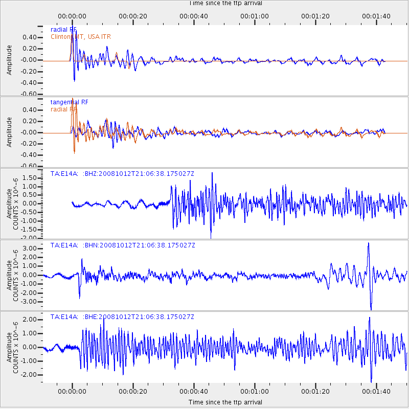
E14A Clinton, MT, USA - Earthquake Result Viewer
*The percent match for this event was below the threshold and hence no stack was calculated.
| Earthquake location: |
Southern Bolivia |
| Earthquake latitude/longitude: |
-20.1/-65.0 |
| Earthquake time(UTC): |
2008/10/12 (286) 20:55:41 GMT |
| Earthquake Depth: |
353 km |
| Earthquake Magnitude: |
6.0 MB, 6.2 MW, 6.2 MW |
| Earthquake Catalog/Contributor: |
WHDF/NEIC |
|
| Network: |
TA USArray Transportable Network (new EarthScope stations) |
| Station: |
E14A Clinton, MT, USA |
| Lat/Lon: |
46.42 N/113.49 W |
| Elevation: |
1675 m |
|
| Distance: |
79.4 deg |
| Az: |
328.177 deg |
| Baz: |
134.258 deg |
| Ray Param: |
$rayparam |
*The percent match for this event was below the threshold and hence was not used in the summary stack. |
|
| Radial Match: |
75.04526 % |
| Radial Bump: |
400 |
| Transverse Match: |
61.4049 % |
| Transverse Bump: |
400 |
| SOD ConfigId: |
2556 |
| Insert Time: |
2010-03-06 15:43:53.073 +0000 |
| GWidth: |
2.5 |
| Max Bumps: |
400 |
| Tol: |
0.001 |
|
Signal To Noise
| Channel | StoN | STA | LTA |
| TA:E14A: :BHN:20081012T21:06:38.175027Z | 8.54382 | 7.5882207E-7 | 8.881531E-8 |
| TA:E14A: :BHE:20081012T21:06:38.175027Z | 5.008645 | 6.1242844E-7 | 1.2227427E-7 |
| TA:E14A: :BHZ:20081012T21:06:38.175027Z | 4.8497663 | 5.6589084E-7 | 1.1668415E-7 |
| Arrivals |
| Ps | |
| PpPs | |
| PsPs/PpSs | |


