You are here: Home > Network List > TA - USArray Transportable Network (new EarthScope stations) Stations List
> Station E14A Clinton, MT, USA > Earthquake Result Viewer
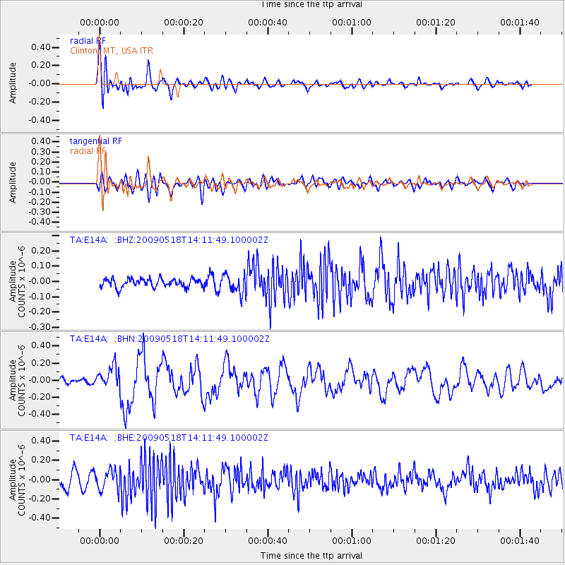
E14A Clinton, MT, USA - Earthquake Result Viewer
*The percent match for this event was below the threshold and hence no stack was calculated.
| Earthquake location: |
Near Coast Of Peru |
| Earthquake latitude/longitude: |
-15.7/-74.8 |
| Earthquake time(UTC): |
2009/05/18 (138) 14:01:04 GMT |
| Earthquake Depth: |
23 km |
| Earthquake Magnitude: |
5.5 MS, 5.3 MB, 5.8 MW, 5.8 MW |
| Earthquake Catalog/Contributor: |
WHDF/NEIC |
|
| Network: |
TA USArray Transportable Network (new EarthScope stations) |
| Station: |
E14A Clinton, MT, USA |
| Lat/Lon: |
46.42 N/113.49 W |
| Elevation: |
1675 m |
|
| Distance: |
70.9 deg |
| Az: |
332.79 deg |
| Baz: |
140.454 deg |
| Ray Param: |
$rayparam |
*The percent match for this event was below the threshold and hence was not used in the summary stack. |
|
| Radial Match: |
59.62122 % |
| Radial Bump: |
400 |
| Transverse Match: |
57.474537 % |
| Transverse Bump: |
400 |
| SOD ConfigId: |
2760 |
| Insert Time: |
2010-03-06 15:44:07.046 +0000 |
| GWidth: |
2.5 |
| Max Bumps: |
400 |
| Tol: |
0.001 |
|
Signal To Noise
| Channel | StoN | STA | LTA |
| TA:E14A: :BHN:20090518T14:11:49.100002Z | 3.3929563 | 1.2770053E-7 | 3.763695E-8 |
| TA:E14A: :BHE:20090518T14:11:49.100002Z | 1.3739812 | 1.02476506E-7 | 7.458363E-8 |
| TA:E14A: :BHZ:20090518T14:11:49.100002Z | 2.3108923 | 6.2434495E-8 | 2.7017483E-8 |
| Arrivals |
| Ps | |
| PpPs | |
| PsPs/PpSs | |


