You are here: Home > Network List > TA - USArray Transportable Network (new EarthScope stations) Stations List
> Station E14A Clinton, MT, USA > Earthquake Result Viewer
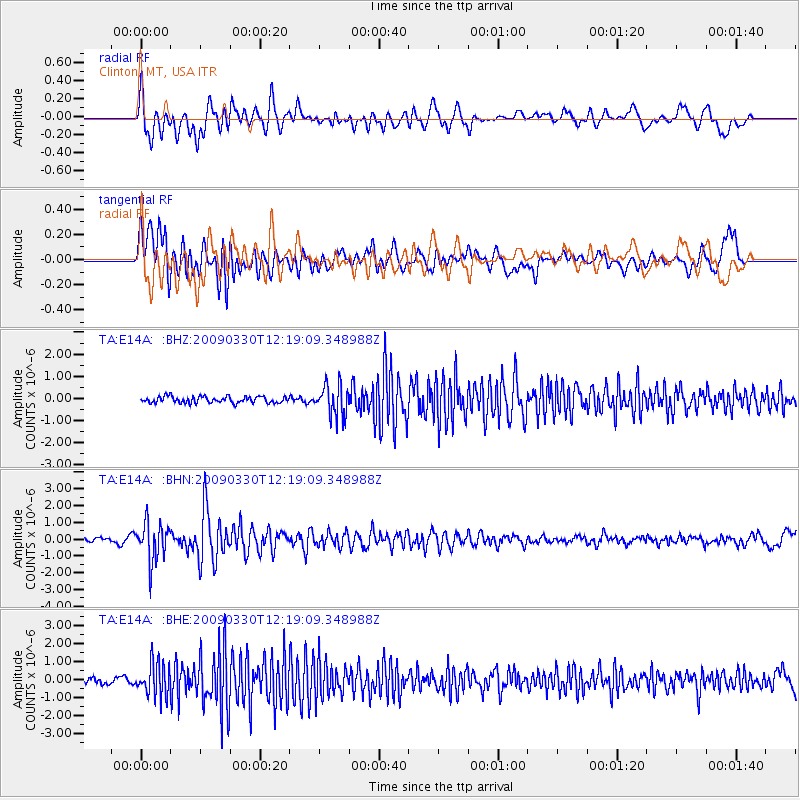
E14A Clinton, MT, USA - Earthquake Result Viewer
*The percent match for this event was below the threshold and hence no stack was calculated.
| Earthquake location: |
Andreanof Islands, Aleutian Is. |
| Earthquake latitude/longitude: |
51.5/-178.3 |
| Earthquake time(UTC): |
2009/03/30 (089) 12:11:54 GMT |
| Earthquake Depth: |
31 km |
| Earthquake Magnitude: |
6.0 MB, 5.8 MW, 5.7 MW |
| Earthquake Catalog/Contributor: |
WHDF/NEIC |
|
| Network: |
TA USArray Transportable Network (new EarthScope stations) |
| Station: |
E14A Clinton, MT, USA |
| Lat/Lon: |
46.42 N/113.49 W |
| Elevation: |
1675 m |
|
| Distance: |
41.6 deg |
| Az: |
70.564 deg |
| Baz: |
301.622 deg |
| Ray Param: |
$rayparam |
*The percent match for this event was below the threshold and hence was not used in the summary stack. |
|
| Radial Match: |
78.65229 % |
| Radial Bump: |
400 |
| Transverse Match: |
69.91574 % |
| Transverse Bump: |
400 |
| SOD ConfigId: |
2658 |
| Insert Time: |
2010-03-06 15:44:32.189 +0000 |
| GWidth: |
2.5 |
| Max Bumps: |
400 |
| Tol: |
0.001 |
|
Signal To Noise
| Channel | StoN | STA | LTA |
| TA:E14A: :BHN:20090330T12:19:09.348988Z | 7.8325143 | 1.133027E-6 | 1.4465687E-7 |
| TA:E14A: :BHE:20090330T12:19:09.348988Z | 6.430564 | 9.287426E-7 | 1.4442631E-7 |
| TA:E14A: :BHZ:20090330T12:19:09.348988Z | 4.9282694 | 7.092224E-7 | 1.4390902E-7 |
| Arrivals |
| Ps | |
| PpPs | |
| PsPs/PpSs | |


