You are here: Home > Network List > AZ - ANZA Regional Network Stations List
> Station FRD AZ.FRD > Earthquake Result Viewer
FRD AZ.FRD - Earthquake Result Viewer
*The percent match for this event was below the threshold and hence no stack was calculated.
| Earthquake location: |
Southeast Of Loyalty Islands |
| Earthquake latitude/longitude: |
-22.1/170.0 |
| Earthquake time(UTC): |
2018/09/10 (253) 19:31:42 GMT |
| Earthquake Depth: |
10 km |
| Earthquake Magnitude: |
6.6 Mi |
| Earthquake Catalog/Contributor: |
NEIC PDE/at |
|
| Network: |
AZ ANZA Regional Network |
| Station: |
FRD AZ.FRD |
| Lat/Lon: |
33.49 N/116.60 W |
| Elevation: |
1164 m |
|
| Distance: |
89.1 deg |
| Az: |
53.216 deg |
| Baz: |
242.73 deg |
| Ray Param: |
$rayparam |
*The percent match for this event was below the threshold and hence was not used in the summary stack. |
|
| Radial Match: |
42.301777 % |
| Radial Bump: |
400 |
| Transverse Match: |
66.06878 % |
| Transverse Bump: |
400 |
| SOD ConfigId: |
13570011 |
| Insert Time: |
2019-05-01 05:18:29.507 +0000 |
| GWidth: |
2.5 |
| Max Bumps: |
400 |
| Tol: |
0.001 |
|
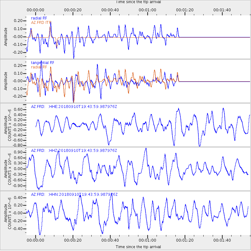
Signal To Noise
| Channel | StoN | STA | LTA |
| AZ:FRD: :HHZ:20180910T19:43:59.987976Z | 5.5927362 | 7.736641E-7 | 1.3833375E-7 |
| AZ:FRD: :HHN:20180910T19:43:59.987976Z | 1.2113849 | 2.9195715E-7 | 2.4101107E-7 |
| AZ:FRD: :HHE:20180910T19:43:59.987976Z | 2.8378901 | 4.4045862E-7 | 1.5520638E-7 |
| Arrivals |
| Ps | |
| PpPs | |
| PsPs/PpSs | |


