You are here: Home > Network List > CI - Caltech Regional Seismic Network Stations List
> Station MPM Manuel Prospect Mine, California, USA > Earthquake Result Viewer
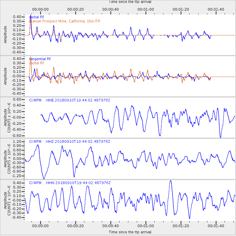
MPM Manuel Prospect Mine, California, USA - Earthquake Result Viewer
*The percent match for this event was below the threshold and hence no stack was calculated.
| Earthquake location: |
Southeast Of Loyalty Islands |
| Earthquake latitude/longitude: |
-22.1/170.0 |
| Earthquake time(UTC): |
2018/09/10 (253) 19:31:42 GMT |
| Earthquake Depth: |
10 km |
| Earthquake Magnitude: |
6.6 Mi |
| Earthquake Catalog/Contributor: |
NEIC PDE/at |
|
| Network: |
CI Caltech Regional Seismic Network |
| Station: |
MPM Manuel Prospect Mine, California, USA |
| Lat/Lon: |
36.06 N/117.49 W |
| Elevation: |
185 m |
|
| Distance: |
89.6 deg |
| Az: |
50.611 deg |
| Baz: |
242.197 deg |
| Ray Param: |
$rayparam |
*The percent match for this event was below the threshold and hence was not used in the summary stack. |
|
| Radial Match: |
71.30691 % |
| Radial Bump: |
400 |
| Transverse Match: |
65.690895 % |
| Transverse Bump: |
360 |
| SOD ConfigId: |
13570011 |
| Insert Time: |
2019-05-01 05:19:34.509 +0000 |
| GWidth: |
2.5 |
| Max Bumps: |
400 |
| Tol: |
0.001 |
|
Signal To Noise
| Channel | StoN | STA | LTA |
| CI:MPM: :HHZ:20180910T19:44:02.487976Z | 6.642897 | 8.888247E-7 | 1.3380077E-7 |
| CI:MPM: :HHN:20180910T19:44:02.487976Z | 1.1899455 | 1.603591E-7 | 1.3476173E-7 |
| CI:MPM: :HHE:20180910T19:44:02.487976Z | 2.0415063 | 2.2822616E-7 | 1.1179302E-7 |
| Arrivals |
| Ps | |
| PpPs | |
| PsPs/PpSs | |


