You are here: Home > Network List > TA - USArray Transportable Network (new EarthScope stations) Stations List
> Station E14A Clinton, MT, USA > Earthquake Result Viewer
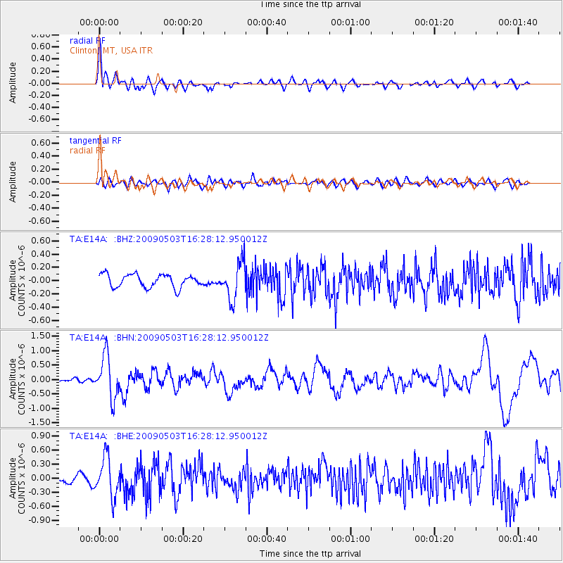
E14A Clinton, MT, USA - Earthquake Result Viewer
*The percent match for this event was below the threshold and hence no stack was calculated.
| Earthquake location: |
Guatemala |
| Earthquake latitude/longitude: |
14.6/-91.2 |
| Earthquake time(UTC): |
2009/05/03 (123) 16:21:47 GMT |
| Earthquake Depth: |
124 km |
| Earthquake Magnitude: |
5.6 MB, 6.2 MW, 6.2 MW |
| Earthquake Catalog/Contributor: |
WHDF/NEIC |
|
| Network: |
TA USArray Transportable Network (new EarthScope stations) |
| Station: |
E14A Clinton, MT, USA |
| Lat/Lon: |
46.42 N/113.49 W |
| Elevation: |
1675 m |
|
| Distance: |
36.9 deg |
| Az: |
334.014 deg |
| Baz: |
142.178 deg |
| Ray Param: |
$rayparam |
*The percent match for this event was below the threshold and hence was not used in the summary stack. |
|
| Radial Match: |
75.5829 % |
| Radial Bump: |
400 |
| Transverse Match: |
57.481796 % |
| Transverse Bump: |
400 |
| SOD ConfigId: |
2760 |
| Insert Time: |
2010-03-06 15:45:07.519 +0000 |
| GWidth: |
2.5 |
| Max Bumps: |
400 |
| Tol: |
0.001 |
|
Signal To Noise
| Channel | StoN | STA | LTA |
| TA:E14A: :BHN:20090503T16:28:12.950012Z | 5.7718325 | 7.51249E-7 | 1.301578E-7 |
| TA:E14A: :BHE:20090503T16:28:12.950012Z | 4.471385 | 4.343203E-7 | 9.713329E-8 |
| TA:E14A: :BHZ:20090503T16:28:12.950012Z | 2.9202645 | 2.8463018E-7 | 9.7467264E-8 |
| Arrivals |
| Ps | |
| PpPs | |
| PsPs/PpSs | |


