You are here: Home > Network List > US - United States National Seismic Network Stations List
> Station CBKS Cedar Bluff, Kansas, USA > Earthquake Result Viewer
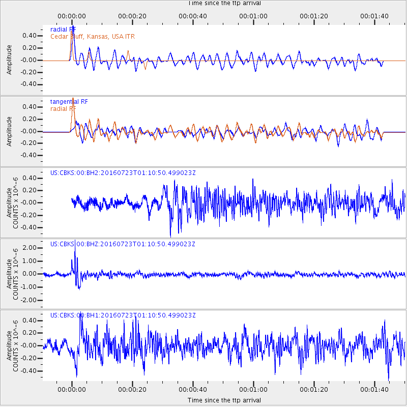
CBKS Cedar Bluff, Kansas, USA - Earthquake Result Viewer
*The percent match for this event was below the threshold and hence no stack was calculated.
| Earthquake location: |
Northwest Of Kuril Islands |
| Earthquake latitude/longitude: |
47.7/147.0 |
| Earthquake time(UTC): |
2016/07/23 (205) 01:00:21 GMT |
| Earthquake Depth: |
407 km |
| Earthquake Magnitude: |
5.7 MB |
| Earthquake Catalog/Contributor: |
NEIC PDE/NEIC ALERT |
|
| Network: |
US United States National Seismic Network |
| Station: |
CBKS Cedar Bluff, Kansas, USA |
| Lat/Lon: |
38.81 N/99.74 W |
| Elevation: |
677 m |
|
| Distance: |
75.4 deg |
| Az: |
47.843 deg |
| Baz: |
320.143 deg |
| Ray Param: |
$rayparam |
*The percent match for this event was below the threshold and hence was not used in the summary stack. |
|
| Radial Match: |
73.799614 % |
| Radial Bump: |
400 |
| Transverse Match: |
71.89437 % |
| Transverse Bump: |
400 |
| SOD ConfigId: |
1634031 |
| Insert Time: |
2016-08-06 01:14:14.141 +0000 |
| GWidth: |
2.5 |
| Max Bumps: |
400 |
| Tol: |
0.001 |
|
Signal To Noise
| Channel | StoN | STA | LTA |
| US:CBKS:00:BHZ:20160723T01:10:50.499023Z | 10.112661 | 7.063265E-7 | 6.984576E-8 |
| US:CBKS:00:BH1:20160723T01:10:50.499023Z | 4.044802 | 2.3753772E-7 | 5.8726656E-8 |
| US:CBKS:00:BH2:20160723T01:10:50.499023Z | 3.414855 | 1.9993799E-7 | 5.854948E-8 |
| Arrivals |
| Ps | |
| PpPs | |
| PsPs/PpSs | |


