You are here: Home > Network List > US - United States National Seismic Network Stations List
> Station DGMT Dagmar, Montana, USA > Earthquake Result Viewer
DGMT Dagmar, Montana, USA - Earthquake Result Viewer
*The percent match for this event was below the threshold and hence no stack was calculated.
| Earthquake location: |
Northwest Of Kuril Islands |
| Earthquake latitude/longitude: |
47.7/147.0 |
| Earthquake time(UTC): |
2016/07/23 (205) 01:00:21 GMT |
| Earthquake Depth: |
407 km |
| Earthquake Magnitude: |
5.7 MB |
| Earthquake Catalog/Contributor: |
NEIC PDE/NEIC ALERT |
|
| Network: |
US United States National Seismic Network |
| Station: |
DGMT Dagmar, Montana, USA |
| Lat/Lon: |
48.47 N/104.20 W |
| Elevation: |
0.0 m |
|
| Distance: |
66.1 deg |
| Az: |
43.542 deg |
| Baz: |
315.644 deg |
| Ray Param: |
$rayparam |
*The percent match for this event was below the threshold and hence was not used in the summary stack. |
|
| Radial Match: |
73.6446 % |
| Radial Bump: |
400 |
| Transverse Match: |
63.25999 % |
| Transverse Bump: |
400 |
| SOD ConfigId: |
1634031 |
| Insert Time: |
2016-08-06 01:14:35.777 +0000 |
| GWidth: |
2.5 |
| Max Bumps: |
400 |
| Tol: |
0.001 |
|
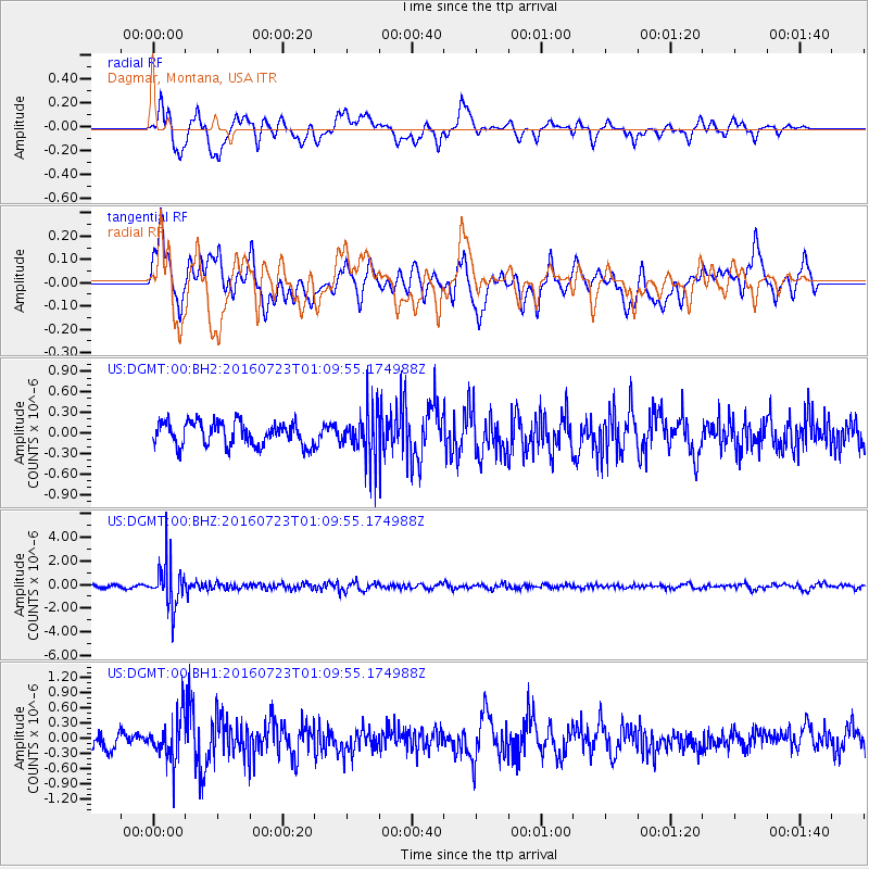
Signal To Noise
| Channel | StoN | STA | LTA |
| US:DGMT:00:BHZ:20160723T01:09:55.174988Z | 16.181837 | 1.8202828E-6 | 1.1248927E-7 |
| US:DGMT:00:BH1:20160723T01:09:55.174988Z | 2.0548267 | 4.4835733E-7 | 2.1819716E-7 |
| US:DGMT:00:BH2:20160723T01:09:55.174988Z | 2.0598845 | 3.515941E-7 | 1.7068632E-7 |
| Arrivals |
| Ps | |
| PpPs | |
| PsPs/PpSs | |


