You are here: Home > Network List > TA - USArray Transportable Network (new EarthScope stations) Stations List
> Station E18K Tukpahlearik Creek, AK, USA > Earthquake Result Viewer
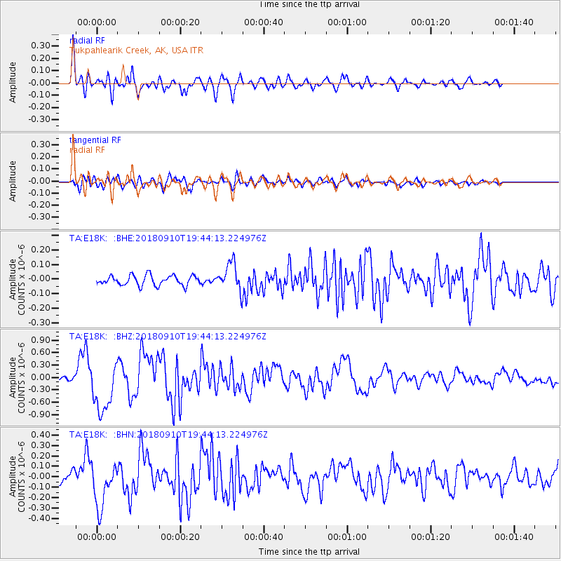
E18K Tukpahlearik Creek, AK, USA - Earthquake Result Viewer
*The percent match for this event was below the threshold and hence no stack was calculated.
| Earthquake location: |
Southeast Of Loyalty Islands |
| Earthquake latitude/longitude: |
-22.1/170.0 |
| Earthquake time(UTC): |
2018/09/10 (253) 19:31:42 GMT |
| Earthquake Depth: |
10 km |
| Earthquake Magnitude: |
6.6 Mi |
| Earthquake Catalog/Contributor: |
NEIC PDE/at |
|
| Network: |
TA USArray Transportable Network (new EarthScope stations) |
| Station: |
E18K Tukpahlearik Creek, AK, USA |
| Lat/Lon: |
67.42 N/160.60 W |
| Elevation: |
297 m |
|
| Distance: |
91.9 deg |
| Az: |
10.933 deg |
| Baz: |
207.096 deg |
| Ray Param: |
$rayparam |
*The percent match for this event was below the threshold and hence was not used in the summary stack. |
|
| Radial Match: |
85.68415 % |
| Radial Bump: |
400 |
| Transverse Match: |
78.968094 % |
| Transverse Bump: |
400 |
| SOD ConfigId: |
13570011 |
| Insert Time: |
2019-05-01 05:22:12.792 +0000 |
| GWidth: |
2.5 |
| Max Bumps: |
400 |
| Tol: |
0.001 |
|
Signal To Noise
| Channel | StoN | STA | LTA |
| TA:E18K: :BHZ:20180910T19:44:13.224976Z | 15.272375 | 6.328969E-7 | 4.1440632E-8 |
| TA:E18K: :BHN:20180910T19:44:13.224976Z | 4.4086328 | 2.1743799E-7 | 4.9320956E-8 |
| TA:E18K: :BHE:20180910T19:44:13.224976Z | 2.7061298 | 9.1387015E-8 | 3.3770373E-8 |
| Arrivals |
| Ps | |
| PpPs | |
| PsPs/PpSs | |


