
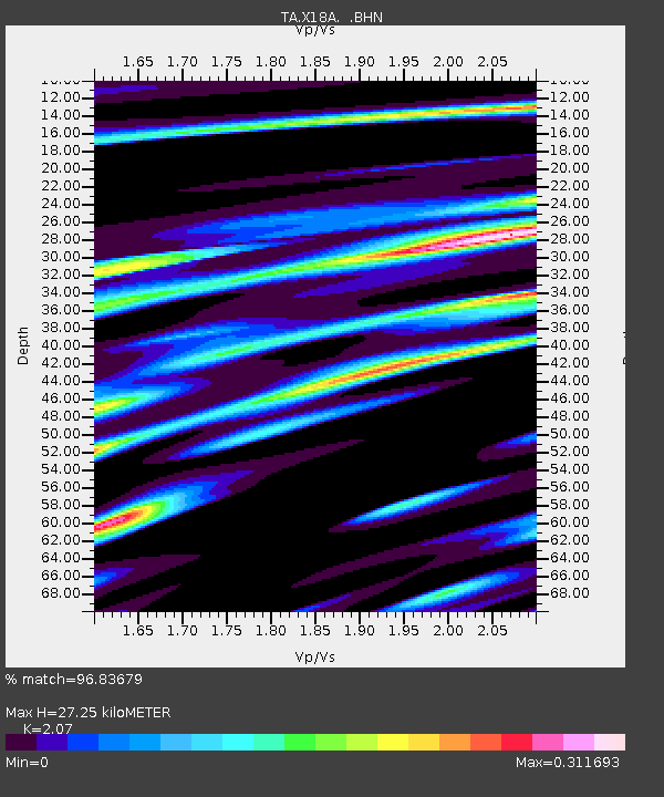
X18A Snowflake, AZ, USA - Earthquake Result Viewer
| ||||||||||||||||||
| ||||||||||||||||||
| ||||||||||||||||||
|
Signal To Noise
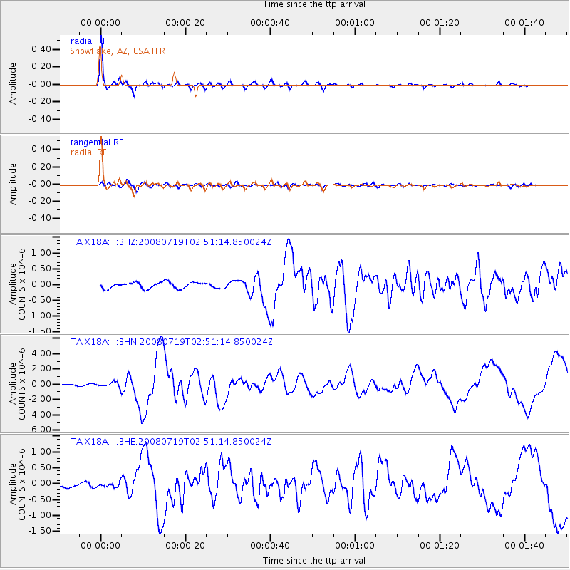
| Channel | StoN | STA | LTA |
| TA:X18A: :BHN:20080719T02:51:14.850024Z | 4.2139053 | 3.473396E-7 | 8.242701E-8 |
| TA:X18A: :BHE:20080719T02:51:14.850024Z | 0.7732317 | 8.0207876E-8 | 1.0373071E-7 |
| TA:X18A: :BHZ:20080719T02:51:14.850024Z | 1.3109398 | 1.2523388E-7 | 9.552985E-8 |
| Arrivals | |
| Ps | 4.6 SECOND |
| PpPs | 13 SECOND |
| PsPs/PpSs | 17 SECOND |

