You are here: Home > Network List > US - United States National Seismic Network Stations List
> Station HAWA Hanford, Washington, USA > Earthquake Result Viewer
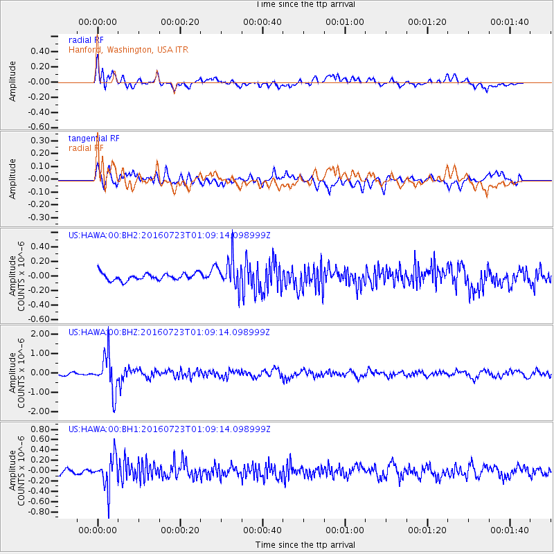
HAWA Hanford, Washington, USA - Earthquake Result Viewer
*The percent match for this event was below the threshold and hence no stack was calculated.
| Earthquake location: |
Northwest Of Kuril Islands |
| Earthquake latitude/longitude: |
47.7/147.0 |
| Earthquake time(UTC): |
2016/07/23 (205) 01:00:21 GMT |
| Earthquake Depth: |
407 km |
| Earthquake Magnitude: |
5.7 MB |
| Earthquake Catalog/Contributor: |
NEIC PDE/NEIC ALERT |
|
| Network: |
US United States National Seismic Network |
| Station: |
HAWA Hanford, Washington, USA |
| Lat/Lon: |
46.39 N/119.53 W |
| Elevation: |
364 m |
|
| Distance: |
59.8 deg |
| Az: |
53.096 deg |
| Baz: |
308.713 deg |
| Ray Param: |
$rayparam |
*The percent match for this event was below the threshold and hence was not used in the summary stack. |
|
| Radial Match: |
70.75126 % |
| Radial Bump: |
400 |
| Transverse Match: |
70.07381 % |
| Transverse Bump: |
400 |
| SOD ConfigId: |
1634031 |
| Insert Time: |
2016-08-06 01:15:38.455 +0000 |
| GWidth: |
2.5 |
| Max Bumps: |
400 |
| Tol: |
0.001 |
|
Signal To Noise
| Channel | StoN | STA | LTA |
| US:HAWA:00:BHZ:20160723T01:09:14.098999Z | 10.561675 | 9.7995E-7 | 9.278358E-8 |
| US:HAWA:00:BH1:20160723T01:09:14.098999Z | 5.405092 | 2.9962135E-7 | 5.5433166E-8 |
| US:HAWA:00:BH2:20160723T01:09:14.098999Z | 4.2908497 | 2.083582E-7 | 4.855873E-8 |
| Arrivals |
| Ps | |
| PpPs | |
| PsPs/PpSs | |


