X18A Snowflake, AZ, USA - Earthquake Result Viewer
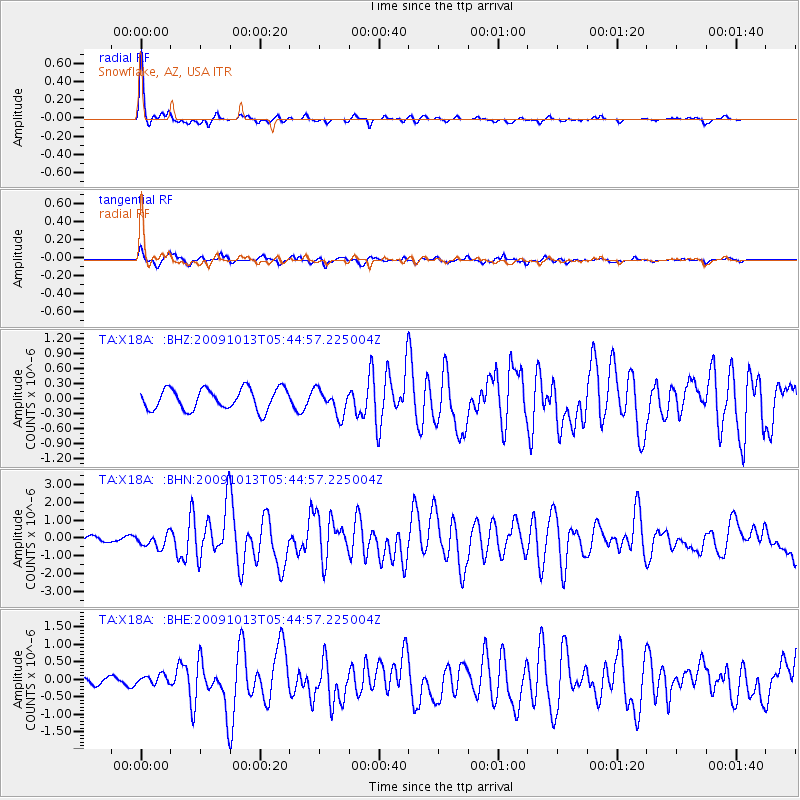
Earthquake location: Fox Islands, Aleutian Islands
Earthquake latitude/longitude: 52.8/-167.0
Earthquake time(UTC): 2009/10/13 (286) 05:37:23 GMT
Earthquake Depth: 24 km
Earthquake Magnitude: 6.0 MB, 6.1 MS, 6.5 MW, 6.5 MW
Earthquake Catalog/Contributor: WHDF/NEIC
Network: TA USArray Transportable Network (new EarthScope stations)
Station: X18A Snowflake, AZ, USA
Lat/Lon: 34.53 N/109.95 W
Elevation: 1751 m
Distance: 43.9 deg
Az: 91.13 deg
Baz: 312.603 deg
Ray Param: 0.0722368
Estimated Moho Depth: 45.0 km
Estimated Crust Vp/Vs: 1.63
Assumed Crust Vp: 6.496 km/s
Estimated Crust Vs: 3.979 km/s
Estimated Crust Poisson's Ratio: 0.20
Radial Match: 93.66005 %
Radial Bump: 263
Transverse Match: 76.104744 %
Transverse Bump: 400
SOD ConfigId: 2622
Insert Time: 2010-03-06 15:46:49.011 +0000
GWidth: 2.5
Max Bumps: 400
Tol: 0.001

Signal To Noise

ChannelStoNSTALTA
TA:X18A: :BHN:20091013T05:44:57.225004Z2.23712443.7468007E-71.674829E-7
TA:X18A: :BHE:20091013T05:44:57.225004Z0.911995771.353356E-71.4839499E-7
TA:X18A: :BHZ:20091013T05:44:57.225004Z1.21012462.5378532E-72.0971834E-7
Arrivals
Ps4.7 SECOND
PpPs17 SECOND
PsPs/PpSs22 SECOND